Old Sloatsburg Cemetery

Why it's listed
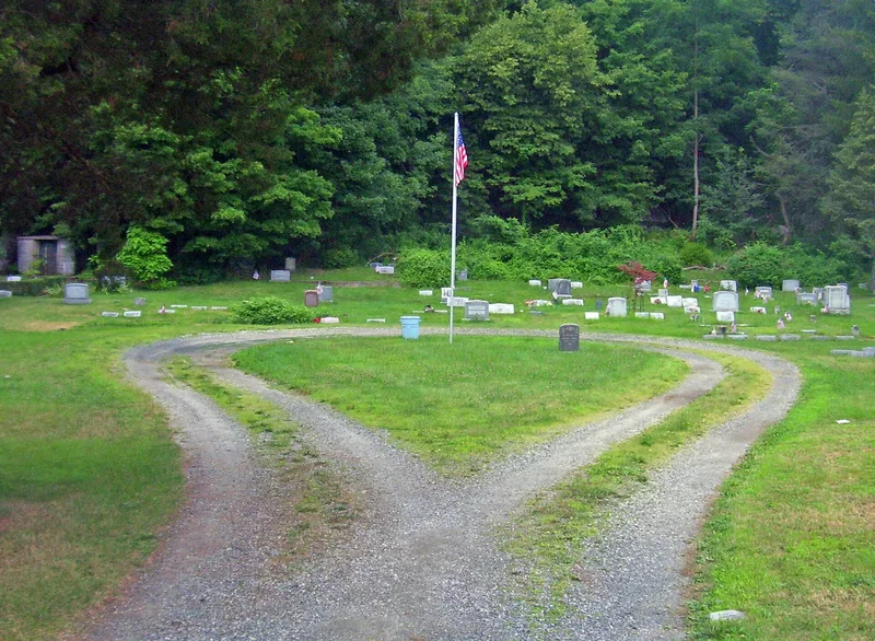
Old Sloatsburg Cemetery occupies five acres in the center of the Village of Sloatsburg, Rockland County. It began in 1781 as a family burial ground when Private John Sloat was buried on a knoll behind the family home. The first non-family burial came in 1852, and the Sloatsburg Cemetery Association formed in 1878. Four sections survive: the raised, drum-shaped Sloat plot, the Hill Section with its circular roadway and groves of conifers, early twentieth-century lawn-style expansions from 1909 and 1914, and the Waldron Section of 1929, which includes four mausolea. The cemetery holds nearly 1,200 headstones. The nomination values it as a local record of changing American cemetery design, moving from the romantic rural cemetery movement to the simpler lawn-park style. After decades of neglect, local residents cleared the grounds in 1996-97 and restored the historic plan, and they continue to maintain it.
Significance in brief: The nomination argues the cemetery is a small-scale rural example of the romantic rural cemetery movement that later took on lawn-park design features. Its four adjoining sections show how national changes in funerary landscape design and attitudes toward death played out in a rural community. It is also a settlement-era burial ground tied to the development of Sloatsburg.
Machine-generated summary. This summary was generated by a language model from the official nomination document and has not been reviewed line by line by an editor. It may contain errors. Check the source document before relying on any detail. Source: nomination document (PDF) · National Archives catalog entry. NRHP reference 99000807, listed July 23, 1999. Summary generated October 2026 (model claude-sonnet-5-5, prompt v1.0-2026-10-29, confidence high).
Key facts
| Address | Richards Rd., Sloatsburg |
|---|---|
| County | Rockland County |
| Listed | July 23, 1999 |
| Reference number | 99000807 |
| Resource type | Site |
| Period of significance | ca.1781-1949 |
| Criteria |
|
| Areas of significance | Art, Landscape Architecture |
| Level of significance | Local |
| Status (as stated in the nomination) | Fell into disuse and became overgrown, then was cleared in 1996-97 by local residents and civic groups, who continue to maintain it. |
| Acreage | 5.5 |
| Coordinates | 41.15365, -74.19604 (NPS GIS) |
What listing means for this property
Sites (archaeological sites, battlefields, landscapes) are often listed with a restricted address to protect them from looting or disturbance. Listing is honorary for private owners; federal undertakings on or near the site go through Section 106 review, and state laws may protect burials and artefacts regardless of listing.
General information, not legal or tax advice. Rules change; confirm with your State Historic Preservation Office or a qualified adviser.
Sources and further reading
- National Park Service, National Register of Historic Places database (snapshot May 2026), reference 99000807.
- Nomination form (PDF, National Archives) — catalog entry
- Wikipedia article (used for cross-checking only; text not reproduced here)
- Wikidata Q1555415
- This listing as JSON
Last updated October 2026. Found an error? See the editorial policy for how to report it.