Barber, Peale's, Farm Mastodon Exhumation Site

Why it's listed
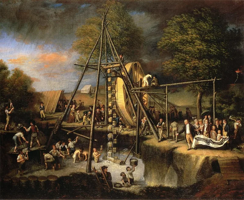
This 2.06-acre site on Route 17K east of Montgomery, New York, is the flooded marl bog where artist and scientist Charles Willson Peale and his team dug for mastodon bones in August 1801. Today it appears as a small, spring-fed pond ringed by natural growth, with the line of the original drainage trench still readable in the landscape. The site has no buildings or structures. It was located in 2004 by local historian Joe Devine, using period accounts, historical maps, elevation models and fieldwork. The Barber farm dig was one of three Orange County excavations that summer, sponsored by the American Philosophical Society with Federal help requested by President Jefferson. The recovered bones allowed Peale to assemble two nearly complete mastodon skeletons, including the first fully articulated prehistoric skeleton. The effort is described as the first American scientific expedition, a landmark in American paleontology, and a contribution to early thinking about extinction and to debates over the American continent's natural history.
Significance in brief: The 1801 excavation, carried out at the Barber farm and two other Orange County sites, helped produce the world's first fully articulated prehistoric skeleton. The work was sponsored by the American Philosophical Society, supported by the Federal government at President Jefferson's request, and is described as the first American scientific expedition. It also fed into early American paleontology and the developing theory of extinction.
Machine-generated summary. This summary was generated by a language model from the official nomination document and has not been reviewed line by line by an editor. It may contain errors. Check the source document before relying on any detail. Source: nomination document (PDF) · National Archives catalog entry. NRHP reference 09000863, listed October 20, 2009. Summary generated October 2026 (model claude-sonnet-5-5, prompt v1.0-2026-10-29, confidence medium).
Key facts
| Address | Rt. 17K, Montgomery |
|---|---|
| County | Orange County |
| Listed | October 20, 2009 |
| Reference number | 09000863 |
| Resource type | Site |
| Period of significance | 1801 |
| Criteria |
|
| Areas of significance | Science, Other |
| Level of significance | National |
| Status (as stated in the nomination) | Unoccupied land with no buildings or structures; a spring-fed pond marks the old excavation, and a residential development is planned for part of the adjoining property. |
| Acreage | 2 |
| Coordinates | 41.52853, -74.21724 (NPS GIS) |
What listing means for this property
Sites (archaeological sites, battlefields, landscapes) are often listed with a restricted address to protect them from looting or disturbance. Listing is honorary for private owners; federal undertakings on or near the site go through Section 106 review, and state laws may protect burials and artefacts regardless of listing.
General information, not legal or tax advice. Rules change; confirm with your State Historic Preservation Office or a qualified adviser.
Sources and further reading
- National Park Service, National Register of Historic Places database (snapshot May 2026), reference 09000863.
- Nomination form (PDF, National Archives) — catalog entry
- Wikipedia article (used for cross-checking only; text not reproduced here)
- Wikidata Q7157905
- This listing as JSON
Last updated October 2026. Found an error? See the editorial policy for how to report it.