Brown's Race Historic District

Why it's listed
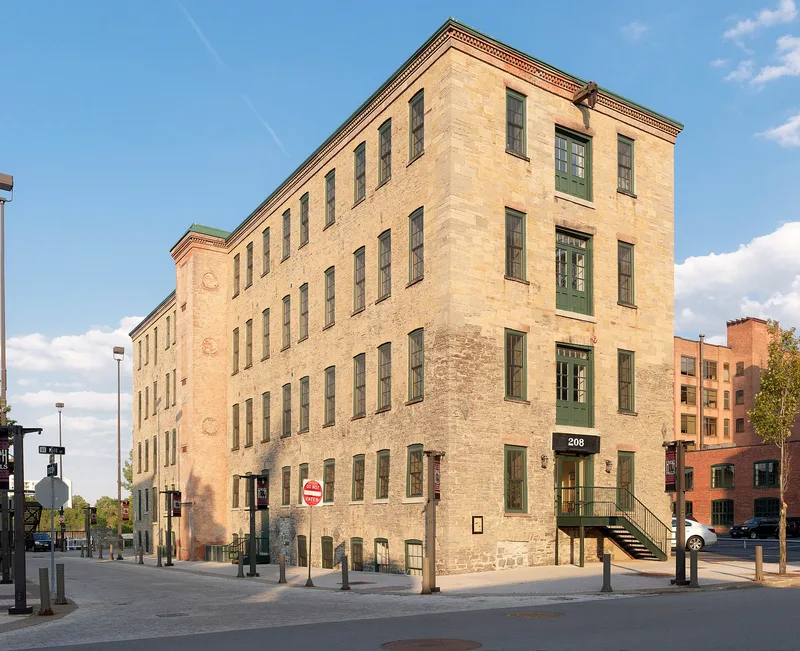
Brown's Race Historic District occupies an industrial corner of Rochester beside the Upper Falls of the Genesee River gorge. It includes 15 contributing buildings, 2 contributing structures and 14 contributing sites, mostly brick and stone factories from the nineteenth century. Notable examples include the six-story Romanesque Revival Gorsline Building, the High Victorian Rochester Water Works, the stone Selye Fire Engine Factory and the former Rochester Button Factory buildings. The structures include the open stone-lined millrace, thirty feet wide and five feet deep, and the iron truss Platt Street Bridge, now used by pedestrians. The district matters because it holds rare surviving evidence of Rochester's milling and manufacturing past. The race is the last visible water-filled raceway in the city, and the Triphammer site contains an overshot water wheel still in place in its pit. Parking lots over vanished mills add high archaeological potential.
Significance in brief: The district preserves rare survivals of Rochester's nineteenth-century industrial heritage, including the last visible water-filled raceway in the city and an in situ overshot water wheel at the Triphammer site. Its masonry mills and factories show the shift from waterpower to steam and electric power. The form also cites high archaeological potential beneath parking lots and former mill sites.
Machine-generated summary. This summary was generated by a language model from the official nomination document and has not been reviewed line by line by an editor. It may contain errors. Check the source document before relying on any detail. Source: nomination document (PDF) · National Archives catalog entry. NRHP reference 89000067, listed March 2, 1989. Summary generated October 2026 (model claude-sonnet-5-5, prompt v1.0-2026-10-29, confidence medium).
Key facts
| Address | Brown's Race St. from Platt St. to Conrail railroad tracks, Rochester |
|---|---|
| County | Monroe County |
| Listed | March 2, 1989 |
| Reference number | 89000067 |
| Resource type | District |
| Architect / builder | Matthew Brown and the Brown brothers (Triphammer) |
| Architectural style | Late Victorian: Second Empire and Romanesque |
| Areas of significance | Industry, Historic - Non-Aboriginal, Engineering, Architecture |
| Level of significance | Local |
| Status (as stated in the nomination) | Principal buildings are used for commercial purposes; the form lists current functions including industry, warehouse, business and vacant/not in use. The Triphammer building burned and was partly demolished, leaving one wall and a water wheel in its pit. |
| Acreage | 11 |
| Coordinates | 43.16055, -77.61525 (NPS GIS) |
What listing means for this property
This is a historic district. Buildings within its boundary are either contributing (they add to the district's significance) or non-contributing. Owners of contributing income-producing buildings can claim the 20% federal rehabilitation tax credit; homeowners should look at state credits. National Register districts impose no design review by themselves; a local historic district ordinance, if one exists, does (the difference explained).
General information, not legal or tax advice. Rules change; confirm with your State Historic Preservation Office or a qualified adviser.
Sources and further reading
- National Park Service, National Register of Historic Places database (snapshot May 2026), reference 89000067.
- Nomination form (PDF, National Archives) — catalog entry
- Wikipedia article (used for cross-checking only; text not reproduced here)
- Wikidata Q4975955
- This listing as JSON
Last updated October 2026. Found an error? See the editorial policy for how to report it.