Lighthouse

Why it's listed
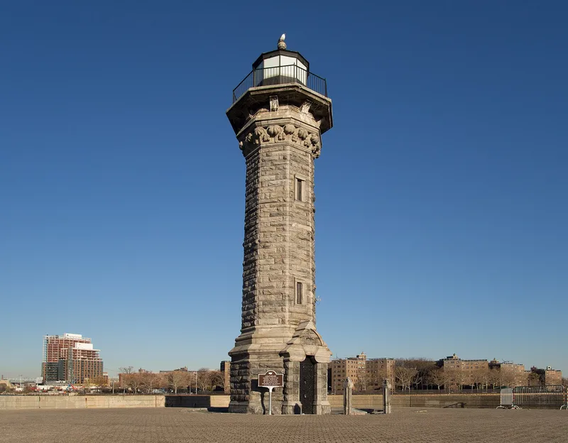
At the northeastern tip of Welfare Island, once known as Blackwell's Island, stands a small octagonal lighthouse about 50 feet tall, dated to around 1842. It was once on its own tiny island, linked to the main island by a bridge. Its walls are rock-faced granite quarried locally, like many other 19th-century structures on the island. Details include seashell corbels under the cornice, a glass and steel light on a balcony with eight brackets, and a doorway topped by a stepped gable incised with a Gothic arch. A flagstone yard and two stone bollards frame the approach. Local legend says a mental patient at the nearby asylum, John McCarthy, built it from the stones of a fort he had raised against a feared British invasion, and an inscribed stone at its base supports the tale. It was recognized for its architecture and its role in transportation. At the time of nomination it stood unused, awaiting restoration.
Significance in brief: The nomination points to its architecture, including rock-faced local granite, seashell corbels and a Gothic-arched gable over the door. It also cites its transportation role as a lighthouse and a legend that a mental patient, John McCarthy, built it from the stones of a fort he had erected.
Machine-generated summary. This summary was generated by a language model from the official nomination document and has not been reviewed line by line by an editor. It may contain errors. Check the source document before relying on any detail. Source: nomination document (PDF) · National Archives catalog entry. NRHP reference 72000876, listed March 16, 1972. Summary generated October 2026 (model claude-sonnet-5-5, prompt v1.0-2026-10-29, confidence medium).
Key facts
| Address | Welfare Island, New York |
|---|---|
| County | Manhattan |
| Listed | March 16, 1972 |
| Reference number | 72000876 |
| Resource type | Structure |
| Period of significance | 19th Century (c.1842) |
| Architect / builder | John McCarthy (per legend and a stone marker at the base) |
| Areas of significance | Transportation, Architecture, Social History |
| Level of significance | State |
| Status (as stated in the nomination) | Listed as in good condition but altered, and unused pending restoration. |
| Acreage | 0.9 |
| Coordinates | 40.77295, -73.94001 (NPS GIS) |
What listing means for this property
For a publicly owned building or structure, listing mainly matters when federal funds, permits or licences are involved: projects then go through Section 106 review so effects on the property are considered. Listing also strengthens applications for preservation grants and, for leased income-producing uses, can enable the federal rehabilitation tax credit.
Noted as vacant in the nomination. Nomination documents can be decades old; current status may differ. If you are considering buying an empty listed property, read the due-diligence checklist.
General information, not legal or tax advice. Rules change; confirm with your State Historic Preservation Office or a qualified adviser.
Sources and further reading
- National Park Service, National Register of Historic Places database (snapshot May 2026), reference 72000876.
- Nomination form (PDF, National Archives) — catalog entry
- Wikipedia article (used for cross-checking only; text not reproduced here)
- Wikidata Q3378188
- This listing as JSON
Last updated October 2026. Found an error? See the editorial policy for how to report it.