Carroll Gardens Historic District

Why it's listed
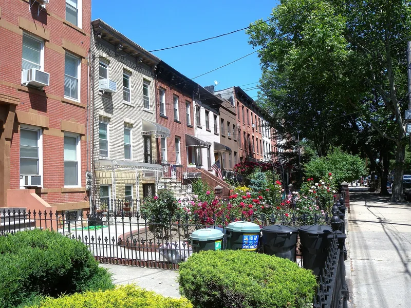
Carroll Gardens Historic District covers about 12 acres in South Brooklyn and includes more than 160 buildings, mostly two- and three-story brownstone rowhouses on Carroll and President Streets between Smith and Hoyt Streets. Built over roughly twenty years from the late 1860s to the early 1880s, the rows reflect the building boom that followed industrial growth in the Red Hook and Gowanus areas. Builders worked to keep setbacks, cornice lines and stoop heights consistent, mostly using late Italianate and neo-Grec designs. The blocks follow an 1846 surveyor's plan that created unusually deep lots, so houses sit behind front yards roughly 25 to 39 feet deep with fenced, landscaped gardens. Both streets are dead ends, which gives the area a secluded feel. Some houses have altered stoops, cornices or facades, and six buildings are considered intrusions, yet the district keeps its nineteenth-century residential character and scale.
Significance in brief: The district is argued to be architecturally significant as a largely intact, cohesive neighborhood of late Italianate and neo-Grec rowhouses. Different builders cooperated on uniform setbacks, scale, materials and complementary designs. Unusually deep lots allowed fenced front yards and landscaped gardens, giving an uncommon sense of open space in the city.
Machine-generated summary. This summary was generated by a language model from the official nomination document and has not been reviewed line by line by an editor. It may contain errors. Check the source document before relying on any detail. Source: nomination document (PDF) · National Archives catalog entry. NRHP reference 83001687, listed September 26, 1983. Summary generated October 2026 (model claude-sonnet-5-5, prompt v1.0-2026-10-29, confidence high).
Key facts
| Address | Carroll and President Sts. between Smith and Hoyt Sts., New York |
|---|---|
| County | Brooklyn |
| Listed | September 26, 1983 |
| Reference number | 83001687 |
| Resource type | District |
| Period of significance | 1860s-1880s |
| Architect / builder | Various |
| Architectural style | Late Italianate and neo-Grec |
| Areas of significance | Community Planning and Development, Architecture |
| Level of significance | Local |
| Status (as stated in the nomination) | Condition marked excellent but altered; mostly residential with shops on Smith Street. Six intrusions are noted, including three modern rowhouses built on the site of a burned church. |
| Acreage | 12 |
| Coordinates | 40.67992, -73.98960 (NPS GIS) |
What listing means for this property
This is a historic district. Buildings within its boundary are either contributing (they add to the district's significance) or non-contributing. Owners of contributing income-producing buildings can claim the 20% federal rehabilitation tax credit; homeowners should look at state credits. National Register districts impose no design review by themselves; a local historic district ordinance, if one exists, does (the difference explained).
General information, not legal or tax advice. Rules change; confirm with your State Historic Preservation Office or a qualified adviser.
Sources and further reading
- National Park Service, National Register of Historic Places database (snapshot May 2026), reference 83001687.
- Nomination form (PDF, National Archives) — catalog entry
- Wikipedia article (used for cross-checking only; text not reproduced here)
- Wikidata Q5046564
- This listing as JSON
Last updated October 2026. Found an error? See the editorial policy for how to report it.