Brooklyn Heights Historic District
Also known as: Brooklyn Heights; See Also:Holy Trinity (Protestant Episcopal

Why it's listed
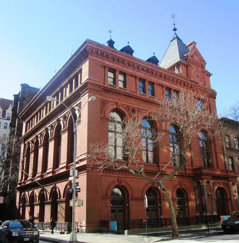
Brooklyn Heights is a 140-acre residential district on a bluff across the East River from lower Manhattan. Its tree-shaded streets, bluestone walks and rows of brick and brownstone houses behind decorative iron fences developed after a steam ferry began running to Manhattan in 1814. Landowners divided their holdings into 25 by 100-foot lots, and the first village map was recorded in 1816. Building began around 1820 along Hicks Street and nearby cross streets. The houses and churches illustrate Federal, Greek Revival, Gothic Revival, Renaissance Revival, Ruskinian Gothic and Queen Anne styles, with Greek Revival the most common. Minard Lafever designed several churches and Packer Collegiate Institute here. Brooklyn Heights was the leading residential area of New York before Fifth Avenue rose to prominence. Local residents also protected it by securing the Esplanade, which carried the Brooklyn-Queens Expressway below the neighborhood. The district retains enough early fabric to serve as a record of nineteenth-century architectural change.
Significance in brief: Brooklyn Heights was the leading residential area of New York City before the rise of Fifth Avenue. Its surviving buildings show nearly every popular nineteenth-century architectural style, from Federal and Greek Revival to Gothic, Renaissance Revival, Ruskinian and Queen Anne, making it almost a textbook of architectural development from the 1820s to the early 1900s. The Brooklyn Heights Association also protected the district's integrity by having the expressway built below the Esplanade.
Machine-generated summary. This summary was generated by a language model from the official nomination document and has not been reviewed line by line by an editor. It may contain errors. Check the source document before relying on any detail. Source: nomination document (PDF) · National Archives catalog entry. NRHP reference 66000524, listed October 15, 1966. Summary generated October 2026 (model claude-sonnet-5-5, prompt v1.0-2026-10-29, confidence medium).
Key facts
| Address | Borough of Brooklyn, bounded by Atlantic Ave., Court and Fulton Sts. and the East River, New York |
|---|---|
| County | Brooklyn |
| Listed | October 15, 1966 |
| Reference number | 66000524 |
| Resource type | District |
| Period of significance | 1800-1899 |
| Architectural style | Federal, Greek Revival, Gothic Revival, Renaissance Revival, Romanesque Revival, Ruskinian Gothic, Queen Anne |
| Areas of significance | Architecture |
| Level of significance | National |
| National Historic Landmark | Yes, designated January 29, 1964 |
| Status (as stated in the nomination) | Occupied and mostly private residential; most private residences are described as well maintained, and the area has been revived as a residential neighborhood over the last two decades. |
| Acreage | 140 |
| Coordinates | 40.69573, -73.99522 (NPS GIS) |
What listing means for this property
This is a historic district. Buildings within its boundary are either contributing (they add to the district's significance) or non-contributing. Owners of contributing income-producing buildings can claim the 20% federal rehabilitation tax credit; homeowners should look at state credits. National Register districts impose no design review by themselves; a local historic district ordinance, if one exists, does (the difference explained).
General information, not legal or tax advice. Rules change; confirm with your State Historic Preservation Office or a qualified adviser.
Sources and further reading
- National Park Service, National Register of Historic Places database (snapshot May 2026), reference 66000524.
- Nomination form (PDF, National Archives) — catalog entry
- Wikipedia article (used for cross-checking only; text not reproduced here)
- Wikidata Q4974842
- This listing as JSON
Last updated October 2026. Found an error? See the editorial policy for how to report it.