Enlarged Erie Canal Historic District (Discontiguous)

Why it's listed
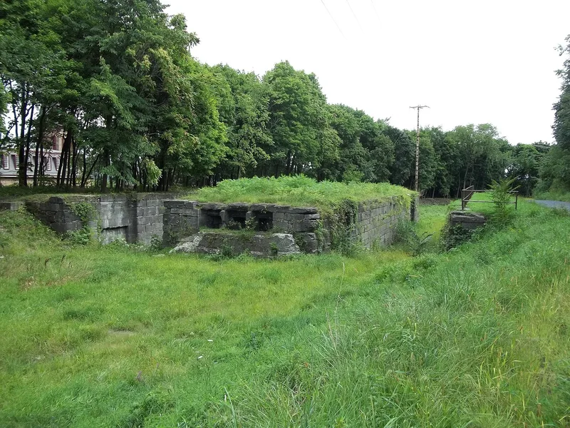
Running through the City of Cohoes, this discontiguous district preserves pieces of the Enlarged Erie Canal, the widened and deepened version of the original canal built between 1836 and 1862. Five numbered units each center on surviving locks between historic Locks 9 and 18, along with berm walls, towpath, prism and a buried stone culvert. Lock 9 and Locks 14, 15 and 17 keep chamber walls and center piers built of coursed limestone ashlar. Other locks are reduced, buried beneath streets or buildings, or incorporated into later structures such as a 1966 firehouse. The canal replaced single-chamber locks with larger double-chamber locks, and engineers including Holmes Hutchinson, John Jervis and William McAlpine shaped the work in this area. The district was recognized for its role in transportation, engineering and commerce, and for the way its surviving features allow the canal's route through the city to be followed.
Significance in brief: The nomination argues the district is significant under Criteria A and C in the areas of transportation, engineering and commerce. It preserves the alignment and engineering of the canal enlarged between 1836 and 1862, which replaced the original single-chamber locks with larger double-chamber locks. Unit 3, with Locks 14 and 15, is described as the most intact and evocative stretch within Cohoes.
Machine-generated summary. This summary was generated by a language model from the official nomination document and has not been reviewed line by line by an editor. It may contain errors. Check the source document before relying on any detail. Source: nomination document (PDF) · National Archives catalog entry. NRHP reference 04000434, listed May 14, 2004. Summary generated October 2026 (model claude-sonnet-5-5, prompt v1.0-2026-10-29, confidence medium).
Key facts
| Address | City of Cohoes, roughly from S to NW city boundary, Cohoes |
|---|---|
| County | Albany County |
| Listed | May 14, 2004 |
| Reference number | 04000434 |
| Resource type | District |
| Period of significance | c. 1836-c. 1917 |
| Architect / builder | Contractors for locks 17 and 18: Merriam, Carr & Co; Barker & Smith. |
| Criteria |
|
| Areas of significance | Transportation, Engineering, Commerce |
| Level of significance | National |
| Status (as stated in the nomination) | Condition varies by unit. Locks 9, 14, 15, 17 and 18 are largely intact. Lock 10 is reduced to remnants. Locks 11, 12, 13 and 16 are buried or built over, and their condition is undetermined. Some canal sections have been filled, and towpath sections were altered with paving blocks in the 1970s. |
| Acreage | 9.9 |
| Coordinates | 42.77730, -73.70327 (NPS GIS) |
What listing means for this property
This is a historic district. Buildings within its boundary are either contributing (they add to the district's significance) or non-contributing. Owners of contributing income-producing buildings can claim the 20% federal rehabilitation tax credit; homeowners should look at state credits. National Register districts impose no design review by themselves; a local historic district ordinance, if one exists, does (the difference explained).
General information, not legal or tax advice. Rules change; confirm with your State Historic Preservation Office or a qualified adviser.
Sources and further reading
- National Park Service, National Register of Historic Places database (snapshot May 2026), reference 04000434.
- Nomination form (PDF, National Archives) — catalog entry
- Wikipedia article (used for cross-checking only; text not reproduced here)
- Wikidata Q5379050
- This listing as JSON
Last updated October 2026. Found an error? See the editorial policy for how to report it.