Olmsted Park System

Why it's listed
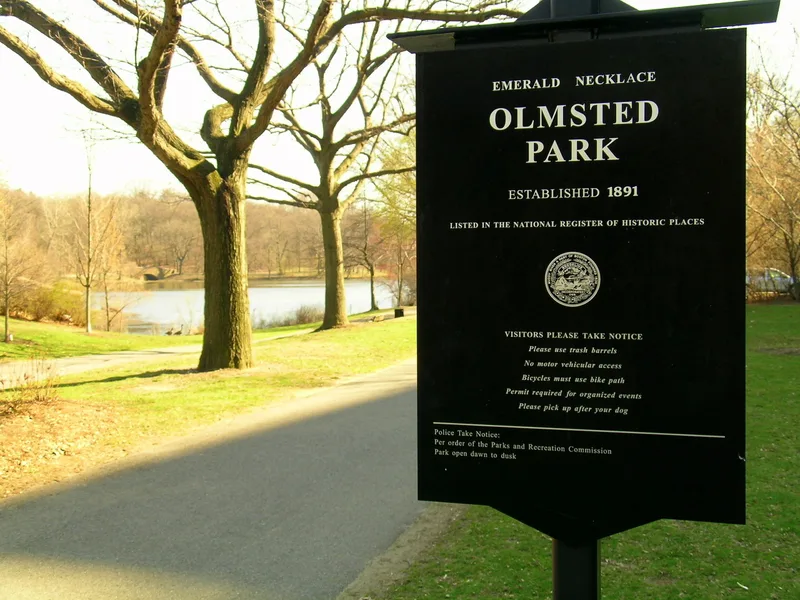
Boston's Olmsted Park System is a chain of parks and parkways, often called the Emerald Necklace, that curves south from the Back Bay Fens through the Muddy River corridor, Jamaica Pond and the Arborway to Franklin Park. Frederick Law Olmsted Sr. planned it in the late 1870s and after, partly to replace a polluted, flood-prone tidal swamp with an informal park. The plan also tied newly annexed parts of the city to its historic center and offered varied recreation, from pond boating to riding and picnicking. Franklin Park, designed in 1885 as a rural retreat for working-class residents, ended the system. Surviving features include bridges and a shelter by Shepley, Rutan and Coolidge, Richardson's Boylston Street bridge, and sculpture by Daniel Chester French. Overpasses, a stadium and other additions have altered parts, but much of Olmsted's road pattern remains. The system is recognized as a national example of large-scale landscape and regional planning.
Significance in brief: The nomination calls it one of the nation's outstanding examples of multi-use open space and Olmsted's finest design project in New England. It joined municipal open space with an engineering fix for sewage and flooding, linked newly annexed areas to the historic city centre, and offered varied recreation. Franklin Park is described as one of Olmsted's masterpieces, designed for working-class people.
Machine-generated summary. This summary was generated by a language model from the official nomination document and has not been reviewed line by line by an editor. It may contain errors. Check the source document before relying on any detail. Source: nomination document (PDF) · National Archives catalog entry. NRHP reference 71000086, listed December 8, 1971. Summary generated October 2026 (model claude-sonnet-5-5, prompt v1.0-2026-10-29, confidence medium).
Key facts
| Address | Encompassing the Back Bay Fens, Muddy River, Olmsted (Leverett Park), Jamaica Park, Arborway, and Franklin Park, Brookline |
|---|---|
| County | Norfolk County |
| Listed | December 8, 1971 |
| Reference number | 71000086 |
| Resource type | District |
| Period of significance | 19th and 20th Century; specific dates 1879, 1881, 1885, 1892 |
| Architect / builder | Frederick Law Olmsted Sr. (landscape design); Shepley, Rutan and Coolidge (bridges and shelter); City Architect Wheelwright; Walker and Best (Valley Gate); Daniel Chester French (sculpture) |
| Areas of significance | Community Planning and Development, Landscape Architecture, Entertainment/Recreation |
| Level of significance | National |
| Status (as stated in the nomination) | Publicly owned and in use as parks. Some original stonework in Franklin Park is in bad condition, and some areas have been altered by overpasses, a stadium, traffic rotaries and other changes. |
| Acreage | 843 |
| Coordinates | 42.32181, -71.11799 (NPS GIS) |
What listing means for this property
This is a historic district. Buildings within its boundary are either contributing (they add to the district's significance) or non-contributing. Owners of contributing income-producing buildings can claim the 20% federal rehabilitation tax credit; homeowners should look at state credits. National Register districts impose no design review by themselves; a local historic district ordinance, if one exists, does (the difference explained).
General information, not legal or tax advice. Rules change; confirm with your State Historic Preservation Office or a qualified adviser.
Sources and further reading
- National Park Service, National Register of Historic Places database (snapshot May 2026), reference 71000086.
- Nomination form (PDF, National Archives) — catalog entry
- Wikipedia article (used for cross-checking only; text not reproduced here)
- Wikidata Q1335396
- This listing as JSON
Last updated October 2026. Found an error? See the editorial policy for how to report it.