Pill Hill Historic District
Also known as: High Street Hill

The pin is a point inside the NPS boundary polygon, not a surveyed location.
Why it's listed
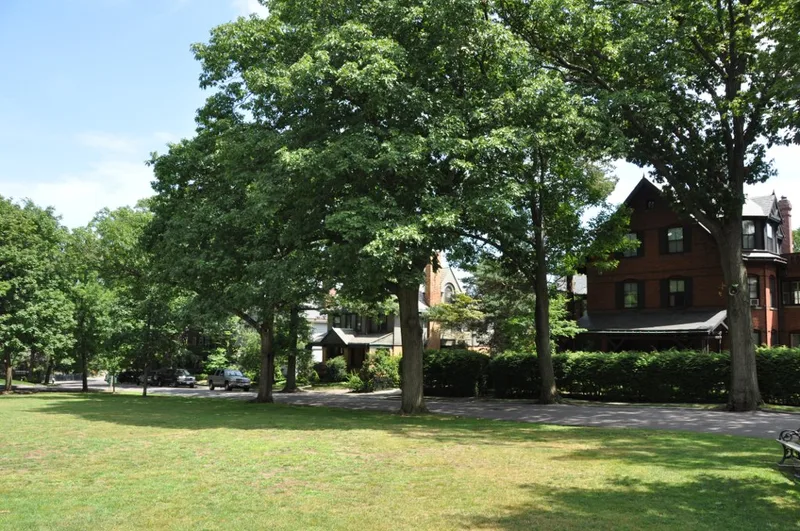
Pill Hill is a hillside neighborhood in the southeast corner of Brookline, Massachusetts, covering about 52 acres and 127 properties. Winding roads, stone walls, picket fences and mature trees frame mostly single-family houses, and several grounds were landscaped by Frederick Law Olmsted. From the hilltop, views reach toward Boston. Houses range from the 1822 Federal-style Tappan-Philbrick estate to Shingle Style, Queen Anne, Stick Style and Colonial Revival homes of the late 1800s, many designed by prominent Boston firms such as Peabody and Stearns and Ware and Van Brunt. Brick, stone, shingle and clapboard recur throughout and give the area a unified look. Development followed the 1844 annexation of Roxbury land and the arrival of the railroad in 1848. Residents included abolitionist Samuel Philbrick, educators and many physicians, which likely gave the hill its name. The Free Hospital for Women moved here in 1895 and pioneered teaching and cancer radiation treatment.
Significance in brief: The district is an aggregation of high-quality works by leading Boston and national architects, unified by consistent scale, materials and landscaping, some of it by Frederick Law Olmsted. It was also home to reformers, educators and many doctors, which gave the hill its name. The Free Hospital for Women, founded by early resident circles and moved there in 1895, was innovative in teaching, gynecology and radiation treatment for cancer.
Machine-generated summary. This summary was generated by a language model from the official nomination document and has not been reviewed line by line by an editor. It may contain errors. Check the source document before relying on any detail. Source: nomination document (PDF) · National Archives catalog entry. NRHP reference 77000187, listed December 16, 1977. Summary generated October 2026 (model claude-sonnet-5-5, prompt v1.0-2026-10-29, confidence medium).
Key facts
| Address | Roughly bounded by Boylston St., Pond Ave., Acron, Oakland and Highland Rds., Brookline |
|---|---|
| County | Norfolk County |
| Listed | December 16, 1977 |
| Reference number | 77000187 |
| Resource type | District |
| Architect / builder | Peabody and Stearns; Ware and Van Brunt; William Ralph Emerson; Shaw and Hunnewell; Arthur Little; Weston and Rand; Clarence Luce; Cabot and Chandler; Hartwell and Richardson |
| Architectural style | Mixed late 19th-century styles: English Cottage, Greek Revival, Mansard, Stick Style, Shingle Style, Queen Anne and Colonial/Federal Revival |
| Areas of significance | Community Planning and Development, Landscape Architecture, Education, Science, Architecture, Social History |
| Level of significance | Local |
| Status (as stated in the nomination) | Condition is marked excellent to good, with the district occupied and mostly private residences. |
| Acreage | 52 |
| Coordinates | 42.32803, -71.11970 (NPS GIS) |
What listing means for this property
This is a historic district. Buildings within its boundary are either contributing (they add to the district's significance) or non-contributing. Owners of contributing income-producing buildings can claim the 20% federal rehabilitation tax credit; homeowners should look at state credits. National Register districts impose no design review by themselves; a local historic district ordinance, if one exists, does (the difference explained).
General information, not legal or tax advice. Rules change; confirm with your State Historic Preservation Office or a qualified adviser.
Sources and further reading
- National Park Service, National Register of Historic Places database (snapshot May 2026), reference 77000187.
- Nomination form (PDF, National Archives) — catalog entry
- Wikipedia article (used for cross-checking only; text not reproduced here)
- Wikidata Q7194103
- This listing as JSON
Last updated October 2026. Found an error? See the editorial policy for how to report it.