Linden Park

Why it's listed
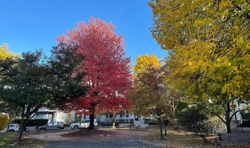
Linden Park is a flat, triangular public green of under an acre in the center of Brookline, surrounded by three-deckers, single-family houses and a church complex. It began in 1843-1844 as part of Linden Place, a controlled residential subdivision laid out by Thomas Aspinwall Davis, a former Mayor of Boston, on land that had been part of a family cherry and apple orchard. Alexander Wadsworth drew the plan, and lots were sold at auction with deed restrictions limiting building near the open spaces and giving owners a common right to the park. Of the three open spaces in the original scheme, only Linden Place and Linden Park remain. In 1899 the lot owners gave the land to the town on condition that it be kept forever as a public park. Original plantings have given way to lawn, walkways, benches and a playground, but the park keeps the open character that distinguished the development.
Significance in brief: The park is a designed open space that complemented the 1843 Linden Place planned subdivision, created by Thomas Aspinwall Davis, once Mayor of Boston. Deed restrictions gave lot owners shared rights to the open space. In 1899 the proprietors gave it to the town on condition that it remain a public park. The form states it meets Criteria A, B and C.
Machine-generated summary. This summary was generated by a language model from the official nomination document and has not been reviewed line by line by an editor. It may contain errors. Check the source document before relying on any detail. Source: nomination document (PDF) · National Archives catalog entry. NRHP reference 85003297, listed October 17, 1985. Summary generated October 2026 (model claude-sonnet-5-5, prompt v1.0-2026-10-29, confidence medium).
Key facts
| Address | Linden Pl. and Linden St., Brookline |
|---|---|
| County | Norfolk County |
| Listed | October 17, 1985 |
| Reference number | 85003297 |
| Resource type | Structure |
| Architect / builder | Alexander Wadsworth (plan); Thomas Aspinwall Davis (developer) |
| Criteria |
|
| Areas of significance | Community Planning and Development |
| Level of significance | National, State, Local |
| Status (as stated in the nomination) | Condition described as good; now grassy areas, walkways, benches and a children's playground with sandbox, partly enclosed by a wrought-iron fence. |
| Acreage | 0.9 |
| Coordinates | 42.34381, -71.11860 (NPS GIS) |
What listing means for this property
For a publicly owned building or structure, listing mainly matters when federal funds, permits or licences are involved: projects then go through Section 106 review so effects on the property are considered. Listing also strengthens applications for preservation grants and, for leased income-producing uses, can enable the federal rehabilitation tax credit.
General information, not legal or tax advice. Rules change; confirm with your State Historic Preservation Office or a qualified adviser.
Sources and further reading
- National Park Service, National Register of Historic Places database (snapshot May 2026), reference 85003297.
- Nomination form (PDF, National Archives) — catalog entry
- Wikipedia article (used for cross-checking only; text not reproduced here)
- Wikidata Q6552338
- This listing as JSON
Last updated October 2026. Found an error? See the editorial policy for how to report it.