Lowell Locks and Canals Historic District
Also known as: See Also:Belvidere Hill Historic District

Why it's listed
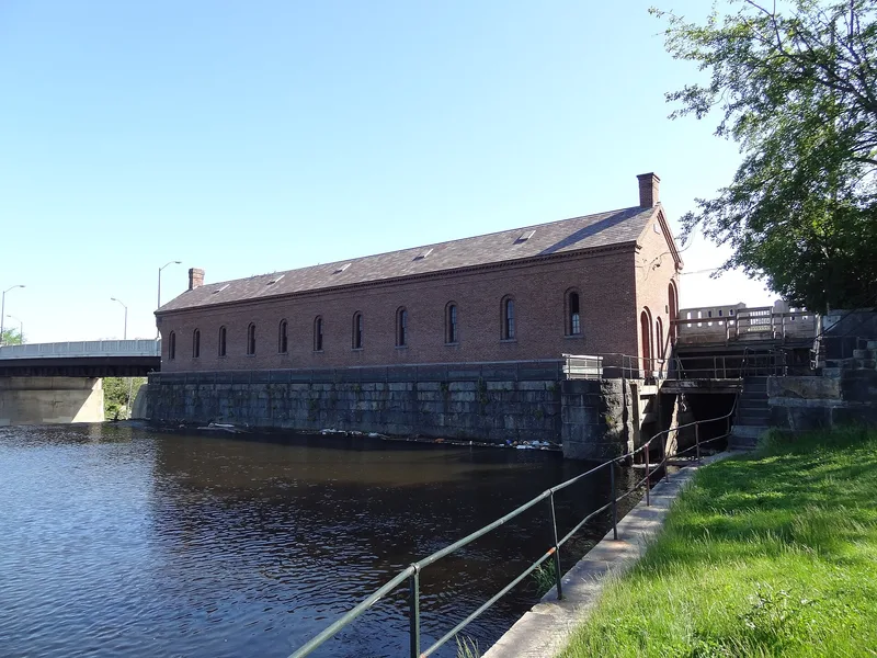
Lowell's canal system, built between 1793 and 1848, forms a district of about 100 acres along roughly five miles of waterways. It includes the Pawtucket Canal, the Northern Canal, the Pawtucket Dam, locks, gatehouses, millyards such as Suffolk, Boott, Hamilton and Lawrence, and three workers' boarding houses. The canals began as a navigation route around Pawtucket Falls, opened in 1796, then were expanded to carry water power to textile mills. Each new canal was built to solve the problem of supplying every mill with enough power, and the Northern Canal finally balanced the flow. The nomination holds that this work, led by engineers including James Francis and George Whistler, drew international attention. It also points to the corporate boarding house system as a widely studied social model. Lowell's population grew from about 200 in 1822 to over 33,000 in 1850. After textile companies moved south, many buildings emptied and deteriorated, and state and federal efforts to restore the area were beginning.
Significance in brief: The nomination argues the canal system drove Lowell's growth as the first great industrial city in the United States and was where large-scale industrialization in North America began. Its hydro-engineering, by James Francis and George Whistler among others, won international recognition. The mill-owned boarding house system served as a model for utopian industrial communities in the United States and Europe.
Machine-generated summary. This summary was generated by a language model from the official nomination document and has not been reviewed line by line by an editor. It may contain errors. Check the source document before relying on any detail. Source: nomination document (PDF) · National Archives catalog entry. NRHP reference 76001972, listed August 13, 1976. Summary generated October 2026 (model claude-sonnet-5-5, prompt v1.0-2026-10-29, confidence medium).
Key facts
| Address | Between Middlesex St. and the Merrimack River, Lowell |
|---|---|
| County | Middlesex County |
| Listed | August 13, 1976 |
| Reference number | 76001972 |
| Resource type | District |
| Period of significance | 1790-1870 |
| Architectural style | Romanesque Revival, with Federal, Greek Revival, Italianate, Queen Anne and High Victorian Gothic elements |
| Areas of significance | Engineering, Industry |
| Level of significance | National |
| National Historic Landmark | Yes, designated December 22, 1977 |
| Status (as stated in the nomination) | Condition is rated fair. Most commercial, industrial and residential buildings in the district have deteriorated. Some mills are still occupied, and the state is acquiring the locks and canals for a heritage park. |
| Acreage | 125 |
| Within district | Lowell National Historical Park |
| Coordinates | 42.64201, -71.31131 (NPS GIS) |
What listing means for this property
This is a historic district. Buildings within its boundary are either contributing (they add to the district's significance) or non-contributing. Owners of contributing income-producing buildings can claim the 20% federal rehabilitation tax credit; homeowners should look at state credits. National Register districts impose no design review by themselves; a local historic district ordinance, if one exists, does (the difference explained).
General information, not legal or tax advice. Rules change; confirm with your State Historic Preservation Office or a qualified adviser.
Sources and further reading
- National Park Service, National Register of Historic Places database (snapshot May 2026), reference 76001972.
- Nomination form (PDF, National Archives) — catalog entry
- Wikipedia article (used for cross-checking only; text not reproduced here)
- Wikidata Q6693255
- This listing as JSON
Last updated October 2026. Found an error? See the editorial policy for how to report it.