Merrill's Wharf Historic District

Why it's listed
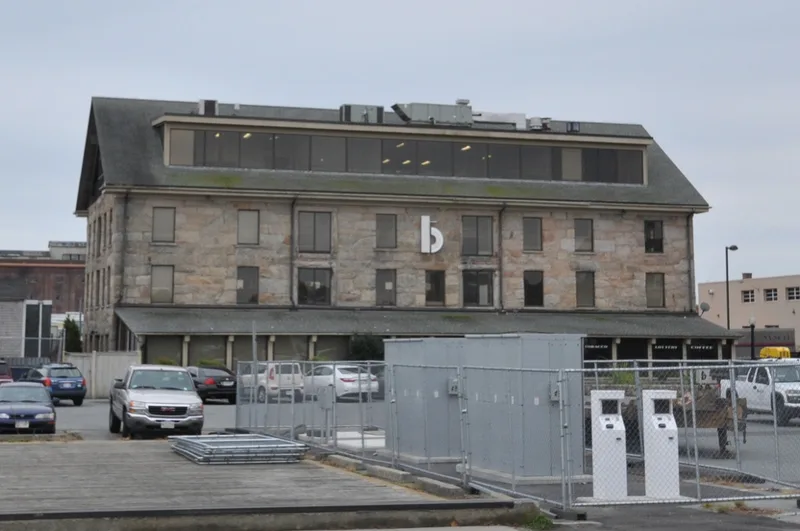
Merrill's Wharf Historic District occupies just under an acre on the New Bedford waterfront and includes the Coal Pocket Pier, the Steamship Authority Pier, the unaltered portion of Merrill's Wharf, and a three-story granite loft building. Captain Edward Merrill bought the land from the Rotch family in 1837 and built the counting house and two piers for his whaling business. The loft building dates to 1847-48. Edward Bourne began whaling operations there in 1848 and eventually owned more whaling ships than any other owner in New England. His counting house office interior was later moved to the Whaling Museum. A sail-making firm worked on the site from 1925 to 1968. The Steamship Authority Pier, built in 1838, served as the departure point for island boats for more than a century. The district was listed as the only remaining unaltered section of the city's waterfront. A 1974 fire damaged the loft building, leaving its upper floors exposed.
Significance in brief: The nomination argues the district is the only remaining unaltered portion of New Bedford's waterfront. Its structures were all built in the first half of the 19th century, during the city's prosperity as a whaling center. It is tied to Captain Edward Merrill's whaling business and later to Edward Bourne, who eventually owned more whaling ships than any other owner in New England.
Machine-generated summary. This summary was generated by a language model from the official nomination document and has not been reviewed line by line by an editor. It may contain errors. Check the source document before relying on any detail. Source: nomination document (PDF) · National Archives catalog entry. NRHP reference 77000167, listed November 11, 1977. Summary generated October 2026 (model claude-sonnet-5-5, prompt v1.0-2026-10-29, confidence medium).
Key facts
| Address | MacArthur Dr., New Bedford |
|---|---|
| County | Bristol County |
| Listed | November 11, 1977 |
| Reference number | 77000167 |
| Resource type | District |
| Architect / builder | Captain Edward Merrill |
| Areas of significance | Commerce, Engineering, Transportation, Architecture |
| Level of significance | State |
| Status (as stated in the nomination) | The Merrill's Wharf Building was damaged by fire in 1974. The first floor has been secured, but the upper floors are exposed to the elements. The piers are used by lobster boats. The owner hoped to sell to a developer who would restore the building. |
| Acreage | 0.9 |
| Coordinates | 41.63311, -70.92035 (NPS GIS) |
What listing means for this property
This is a historic district. Buildings within its boundary are either contributing (they add to the district's significance) or non-contributing. Owners of contributing income-producing buildings can claim the 20% federal rehabilitation tax credit; homeowners should look at state credits. National Register districts impose no design review by themselves; a local historic district ordinance, if one exists, does (the difference explained).
General information, not legal or tax advice. Rules change; confirm with your State Historic Preservation Office or a qualified adviser.
Sources and further reading
- National Park Service, National Register of Historic Places database (snapshot May 2026), reference 77000167.
- Nomination form (PDF, National Archives) — catalog entry
- Wikipedia article (used for cross-checking only; text not reproduced here)
- Wikidata Q6820155
- This listing as JSON
Last updated October 2026. Found an error? See the editorial policy for how to report it.