Corky Row Historic District

Why it's listed
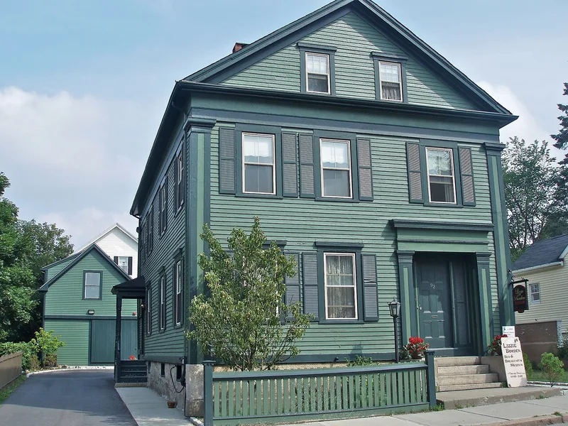
Corky Row is a 96-acre working-class neighborhood just south of downtown Fall River, Massachusetts, bordered roughly by Plymouth Avenue, Second Street, Lyon Street, Hartwell Street and Route 195. Its 435 residential structures are mostly three-story frame tenements of four to six units, many with mansard or gable roofs, bracketed cornices and paired two-story bays. The earliest have Greek Revival door frames. Houses were packed tightly together near the mills and downtown, creating courts and alleys. A cluster of high-style single-family homes along lower Second Street dates to the period before 1874, when mill owners lived near their work. The name comes from the Irish immigrants who dominated the area after 1845 and worked in nearby mills such as Tecumseh, Robeson and Davol. They helped start Fall River's labor movement, and James Tansey, later first president of the United Textile Workers of America, emerged from here. The district shows how mill-workers' housing developed from the Civil War era to World War I.
Significance in brief: The district records how mill-workers' housing evolved in Fall River from the Civil War period to World War I. It was home to the Irish immigrant mill workers who began the city's labor movement, and it produced labor leader James Tansey. It is also an architecturally varied area of tenements, cottages and a few high-style houses.
Machine-generated summary. This summary was generated by a language model from the official nomination document and has not been reviewed line by line by an editor. It may contain errors. Check the source document before relying on any detail. Source: nomination document (PDF) · National Archives catalog entry. NRHP reference 83000656, listed June 23, 1983. Summary generated October 2026 (model claude-sonnet-5-5, prompt v1.0-2026-10-29, confidence medium).
Key facts
| Address | Roughly bounded by Plymouth Ave. I195 and 2nd St., Fall River |
|---|---|
| County | Bristol County |
| Listed | June 23, 1983 |
| Reference number | 83000656 |
| Resource type | District |
| Period of significance | 1800-1910 |
| Architectural style | Greek Revival, Italianate, Second Empire and other Victorian styles; mostly 4-6 unit frame tenement houses and triple deckers |
| Criteria |
|
| Areas of significance | European, Religion |
| Level of significance | National, Local |
| Status (as stated in the nomination) | The form says the district has suffered arson and deterioration in recent years but is struggling toward revitalization. |
| Acreage | 96.2 |
| Coordinates | 41.69523, -71.15616 (NPS GIS) |
What listing means for this property
This is a historic district. Buildings within its boundary are either contributing (they add to the district's significance) or non-contributing. Owners of contributing income-producing buildings can claim the 20% federal rehabilitation tax credit; homeowners should look at state credits. National Register districts impose no design review by themselves; a local historic district ordinance, if one exists, does (the difference explained).
General information, not legal or tax advice. Rules change; confirm with your State Historic Preservation Office or a qualified adviser.
Sources and further reading
- National Park Service, National Register of Historic Places database (snapshot May 2026), reference 83000656.
- Nomination form (PDF, National Archives) — catalog entry
- Wikipedia article (used for cross-checking only; text not reproduced here)
- Wikidata Q5170891
- This listing as JSON
Last updated October 2026. Found an error? See the editorial policy for how to report it.