Cove Burying Ground

Why it's listed
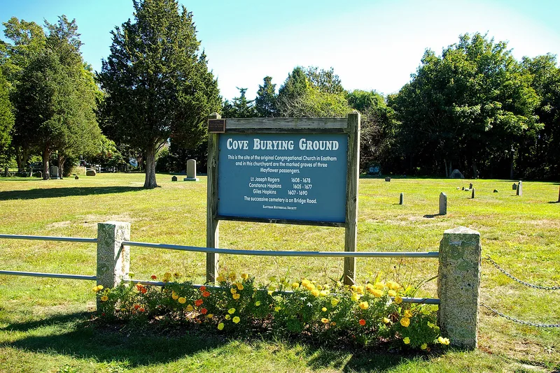
Cove Burying Ground is a roughly one-acre cemetery on Route 6 in Eastham, Cape Cod. It was laid out around 1646 beside the town's first meeting house, near Town Cove, and was used until 1770. It is the main landmark left from the original Nauset settlement. About 50 graves are known, including 37 with original headstones dated 1706 to 1770. Most stones are slate, with a few of sandstone and phyllite. Carved winged skulls, cherubs and foliate borders illustrate Colonial gravestone art, and some stones are attributed to Boston carvers such as Nathaniel Emmes. Family names such as Doane, Freeman, Knowles, Mulford and Sparrow recur. Later boulder and plaque markers honor early settlers and Mayflower passengers, including Constance Hopkins Snow and Giles Hopkins. The Rev. Samuel Treat, the first ordained minister of the church, is also buried here. A granite post and iron rail fence encloses the ground on three sides.
Significance in brief: It is the main landmark surviving from Eastham's original mid-17th century settlement, and many early settlers are buried there. Its 37 surviving original headstones, dated 1706-1770, show a range of Colonial gravestone carving, including work attributed to Boston carvers. Later markers also commemorate founders and Mayflower passengers.
Machine-generated summary. This summary was generated by a language model from the official nomination document and has not been reviewed line by line by an editor. It may contain errors. Check the source document before relying on any detail. Source: nomination document (PDF) · National Archives catalog entry. NRHP reference 99000561, listed May 12, 1999. Summary generated October 2026 (model claude-sonnet-5-5, prompt v1.0-2026-10-29, confidence medium).
Key facts
| Address | Jct. of MA 6 and Pine Woods Rd., Eastham |
|---|---|
| County | Barnstable County |
| Listed | May 12, 1999 |
| Reference number | 99000561 |
| Resource type | Site |
| Areas of significance | Art, Social History, Religion |
| Level of significance | Local |
| Status (as stated in the nomination) | Described as surviving in reasonably good condition, with care from descendants, though many stones show erosion and splitting. Surveys were made in 1876, 1904-05, 1975-76 and 1997, and repairs began in 1975. |
| Acreage | 1 |
| Coordinates | 41.81133, -69.97087 (NPS GIS) |
What listing means for this property
Sites (archaeological sites, battlefields, landscapes) are often listed with a restricted address to protect them from looting or disturbance. Listing is honorary for private owners; federal undertakings on or near the site go through Section 106 review, and state laws may protect burials and artefacts regardless of listing.
General information, not legal or tax advice. Rules change; confirm with your State Historic Preservation Office or a qualified adviser.
Sources and further reading
- National Park Service, National Register of Historic Places database (snapshot May 2026), reference 99000561.
- Nomination form (PDF, National Archives) — catalog entry
- Wikipedia article (used for cross-checking only; text not reproduced here)
- Wikidata Q5178919
- This listing as JSON
Last updated October 2026. Found an error? See the editorial policy for how to report it.