Bridge Road Cemetery

Why it's listed
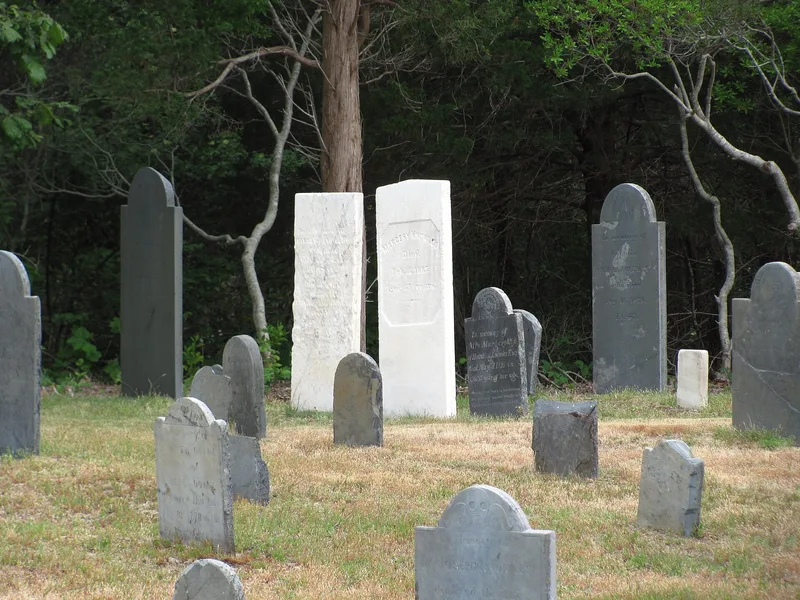
Bridge Road Cemetery is a 1.4-acre burying ground on the west side of Bridge Road in central Eastham, Massachusetts. It was laid out in 1720 alongside the town's second Congregational meeting house and remained in use until 1886, long after the meeting house and town center moved north in 1830. Together with the former Parsonage/Crosby Tavern, it is one of the few surviving reminders of Eastham's 18th and early-19th century center. Most gravestones are slate, with some sandstone, limestone and marble. They show the shift from the winged skull of the Colonial period to the cherub, urn and willow motifs of the Federal era. Several stones are attributed to Boston carvers including William Codner, H.C. Geyer and Lemuel Savery. Many graves belong to families such as Doane, Knowles, Atwood and Freeman. The inscriptions also record local hardship, including children lost in the 1816 epidemic. Surveys in 1905, 1975-76 and 1997 have documented the stones and their condition.
Significance in brief: The cemetery marks the site of Eastham's second meeting house and town center and holds the graves of many of the town's 18th and early-19th century residents. Its slate and other gravestones show changes in New England funerary art from the winged skull to the cherub, urn and willow, including work by noted Boston carvers. The stones and epitaphs also record community events such as the 1816 epidemic.
Machine-generated summary. This summary was generated by a language model from the official nomination document and has not been reviewed line by line by an editor. It may contain errors. Check the source document before relying on any detail. Source: nomination document (PDF) · National Archives catalog entry. NRHP reference 99000636, listed May 27, 1999. Summary generated October 2026 (model claude-sonnet-5-5, prompt v1.0-2026-10-29, confidence medium).
Key facts
| Address | Bridge Rd., Eastham |
|---|---|
| County | Barnstable County |
| Listed | May 27, 1999 |
| Reference number | 99000636 |
| Resource type | Site |
| Areas of significance | Art, Religion, Social History |
| Level of significance | Local |
| Status (as stated in the nomination) | Burials ceased in 1886; the cemetery is still classed as a cemetery. Weathering and freeze/thaw have damaged many stones, especially marble, and repairs began in 1975. |
| Acreage | 1.4 |
| Coordinates | 41.82602, -69.98085 (NPS GIS) |
What listing means for this property
Sites (archaeological sites, battlefields, landscapes) are often listed with a restricted address to protect them from looting or disturbance. Listing is honorary for private owners; federal undertakings on or near the site go through Section 106 review, and state laws may protect burials and artefacts regardless of listing.
General information, not legal or tax advice. Rules change; confirm with your State Historic Preservation Office or a qualified adviser.
Sources and further reading
- National Park Service, National Register of Historic Places database (snapshot May 2026), reference 99000636.
- Nomination form (PDF, National Archives) — catalog entry
- Wikipedia article (used for cross-checking only; text not reproduced here)
- Wikidata Q4966286
- This listing as JSON
Last updated October 2026. Found an error? See the editorial policy for how to report it.