Chicago Portage National Historic Site

Why it's listed
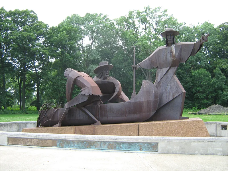
Ninety-one wooded acres in the Cook County Forest Preserve at Forest View, Illinois, preserve the western end of the Chicago Portage. The park includes Portage Creek, part of the Des Plaines River channel and Laughton's and Stony Fords, and is kept natural with only trails, parking, restrooms and picnic areas. A boulder and display case mark its importance. The portage connected the Des Plaines River to Lake Michigan by way of Mud Lake and the Chicago River, linking the St. Lawrence and Mississippi systems. Louis Joliet and Father Jacques Marquette passed through in 1673, and LaSalle followed in 1683. The route served the fur trade and later carried settlers and goods west. The Illinois and Michigan Canal, built in 1836, made the portage unnecessary. Late nineteenth-century diversion of the Des Plaines River and the growth of Chicago erased most traces, leaving Mud Lake gone and Portage Creek stagnant. This tract is valued as the one part of the route that keeps some of its original wooded character.
Significance in brief: The Chicago Portage linked the St. Lawrence and Mississippi river systems and was a main route for exploration, trade and westward settlement. Joliet and Marquette in 1673 were the first recorded explorers to pass through it, and Chicago grew up at this strategic location. The site is described as the only part of the portage route that retains some of its original setting.
Machine-generated summary. This summary was generated by a language model from the official nomination document and has not been reviewed line by line by an editor. It may contain errors. Check the source document before relying on any detail. Source: nomination document (PDF) · National Archives catalog entry. NRHP reference 66000108, listed October 15, 1966. Summary generated October 2026 (model claude-sonnet-5-5, prompt v1.0-2026-10-29, confidence medium).
Key facts
| Address | S. Harlem Ave. at Chicago Sanitary and Ship Canal, Forest View |
|---|---|
| County | Cook County |
| Listed | October 15, 1966 |
| Reference number | 66000108 |
| Resource type | Site |
| Period of significance | 1673; 1836 |
| Areas of significance | Commerce, Transportation, Exploration/Settlement |
| Level of significance | National |
| Status (as stated in the nomination) | Kept in a natural state with minimal development (trails, parking, restrooms, picnic areas); condition marked fair; Portage Creek is stagnant and littered. |
| Acreage | 91.2 |
| Coordinates | 41.80762, -87.80917 (NPS GIS) |
What listing means for this property
Sites (archaeological sites, battlefields, landscapes) are often listed with a restricted address to protect them from looting or disturbance. Listing is honorary for private owners; federal undertakings on or near the site go through Section 106 review, and state laws may protect burials and artefacts regardless of listing.
General information, not legal or tax advice. Rules change; confirm with your State Historic Preservation Office or a qualified adviser.
Sources and further reading
- National Park Service, National Register of Historic Places database (snapshot May 2026), reference 66000108.
- Nomination form (PDF, National Archives) — catalog entry
- Wikipedia article (used for cross-checking only; text not reproduced here)
- Wikidata Q5095746
- This listing as JSON
Last updated October 2026. Found an error? See the editorial policy for how to report it.