Piedmont Park
Also known as: Grounds of Cotton States and International Exposition

Why it's listed
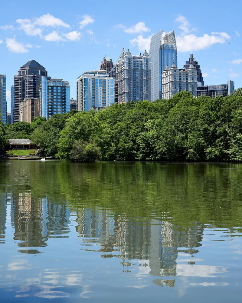
Piedmont Park covers 185 acres in northeast Atlanta, bounded by Tenth Street, Piedmont Road and the Southern Railway line. The land first served as the driving grounds of a gentlemen's club, then as the site of the 1895 Cotton States and International Exposition, which ran for 100 days. Atlanta bought the grounds in 1904 for a city park. Frederick Law Olmsted, Sr. advised on the Exposition plan in 1894, though a local engineer, Grant Wilkins, drew the plan actually used. In 1910 Olmsted Brothers produced a plan of improvement that reshaped the lake, added formal gardens, recreation areas, a golf course and a five-mile driveway, and reused the Exposition's stone stairways and circular urns. Features today include a lake, a meadow, a bandstand and a Peace Monument placed in 1911. The park was listed because it reflects Olmsted's belief that carefully planned parks benefit the health and welfare of city residents.
Significance in brief: The nomination argues the park shows park-planning ideas of Frederick Law Olmsted, Sr., carried out by his sons' firm, Olmsted Brothers. The senior Olmsted was consulted on the 1895 Exposition grounds, and the 1910 plan reflected his design ideas. The park's green space is also of growing value to the surrounding urbanized area.
Machine-generated summary. This summary was generated by a language model from the official nomination document and has not been reviewed line by line by an editor. It may contain errors. Check the source document before relying on any detail. Source: nomination document (PDF) · National Archives catalog entry. NRHP reference 76000629, listed May 13, 1976. Summary generated October 2026 (model claude-sonnet-5-5, prompt v1.0-2026-10-29, confidence medium).
Key facts
| Address | Bounded by 10th St., Southern Rwy. and Piedmont Rd., Atlanta |
|---|---|
| County | Fulton County |
| Listed | May 13, 1976 |
| Reference number | 76000629 |
| Resource type | District |
| Period of significance | 1895-1910 |
| Architect / builder | Frederick Law Olmsted, Sr.; Olmsted Brothers (1910 plan); Grant Wilkins, engineer (Exposition grounds plan); Philip T. Shutze of Hentz, Adler and Shutze (Piedmont Driving Club interiors) |
| Areas of significance | Community Planning and Development, Landscape Architecture |
| Level of significance | National |
| Status (as stated in the nomination) | Condition marked good and unaltered, on its original site, and occupied; used as a public park with unrestricted access. |
| Acreage | 185 |
| Coordinates | 33.78828, -84.37424 (NPS GIS) |
What listing means for this property
This is a historic district. Buildings within its boundary are either contributing (they add to the district's significance) or non-contributing. Owners of contributing income-producing buildings can claim the 20% federal rehabilitation tax credit; homeowners should look at state credits. National Register districts impose no design review by themselves; a local historic district ordinance, if one exists, does (the difference explained).
General information, not legal or tax advice. Rules change; confirm with your State Historic Preservation Office or a qualified adviser.
Sources and further reading
- National Park Service, National Register of Historic Places database (snapshot May 2026), reference 76000629.
- Nomination form (PDF, National Archives) — catalog entry
- Wikipedia article (used for cross-checking only; text not reproduced here)
- Wikidata Q3363884
- This listing as JSON
Last updated October 2026. Found an error? See the editorial policy for how to report it.