Sutter's Fort
Also known as: Sutter's Fort State Historic Monument
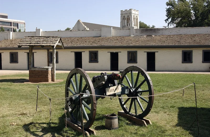

Why it's listed
Sutter's Fort in Sacramento began in 1839 as a large quadrangular adobe fort built by John A. Sutter, a Swiss-born settler. The original fort measured about 330 feet long, with adobe walls 18 to 36 inches thick enclosing some 25 buildings. Because it lay where many overland trails converged, it became the destination of numerous westbound migrants, whom Sutter fed, clothed, sheltered and often employed. By 1845 the settlement included a tannery, gristmill, blacksmith shop and other workshops. After gold was found at Sutter's mill in 1848, workers left and the fort declined. The Native Sons of the Golden West bought it in 1890, and the State of California restored it in 1891-93. It joined the state park system in 1937. Only the two-story central adobe is original; it now displays pioneer artifacts, and reconstructed rooms show crafts such as blacksmithing and rifle-making. The site was recognized for its role in the American settlement of California.
Significance in brief: It was the most strategically located site in Northern California in the 1840s, where most immigrant trails converged. Sutter's hospitality to overland migrants made the fort an invaluable aid to American settlement of California. Its history is also tied to the start of the Gold Rush after gold was found at Sutter's mill in 1848.
Machine-generated summary. This summary was generated by a language model from the official nomination document and has not been reviewed line by line by an editor. It may contain errors. Check the source document before relying on any detail. Source: nomination document (PDF) · National Archives catalog entry. NRHP reference 66000221, listed October 15, 1966. Summary generated October 2026 (model claude-sonnet-5-5, prompt v1.0-2026-10-29, confidence medium).
Key facts
| Address | 2701 L St., Sacramento |
|---|---|
| County | Sacramento County |
| Listed | October 15, 1966 |
| Reference number | 66000221 |
| Resource type | Site |
| Period of significance | 1800-1899 (specific dates 1839-44, 1890-91) |
| Areas of significance | Commerce, Conservation, Exploration/Settlement |
| Level of significance | National |
| National Historic Landmark | Yes, designated January 20, 1961 |
| Status (as stated in the nomination) | Owned by the State of California and operated as a museum with pioneer exhibits; the form describes it as occupied and open to the public. The fort was reconstructed in 1891-93, and only the central two-story adobe is original. |
| Acreage | 8 |
| Coordinates | 38.57255, -121.47127 (NPS GIS) |
What listing means for this property
Sites (archaeological sites, battlefields, landscapes) are often listed with a restricted address to protect them from looting or disturbance. Listing is honorary for private owners; federal undertakings on or near the site go through Section 106 review, and state laws may protect burials and artefacts regardless of listing.
General information, not legal or tax advice. Rules change; confirm with your State Historic Preservation Office or a qualified adviser.
Sources and further reading
- National Park Service, National Register of Historic Places database (snapshot May 2026), reference 66000221.
- Nomination form (PDF, National Archives) — catalog entry
- Wikipedia article (used for cross-checking only; text not reproduced here)
- Wikidata Q2792626
- This listing as JSON
Last updated October 2026. Found an error? See the editorial policy for how to report it.