Angel Island, U.S. Immigration Station

Why it's listed
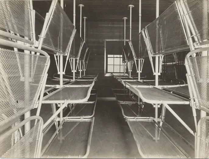
Angel Island, about one square mile in San Francisco Bay southeast of Tiburon, is a hilly island rising roughly 800 feet, with about five miles of shoreline. Juan Manuel de Ayala anchored there in 1775 while charting the bay and gave it its Spanish name. It later became a Mexican cattle ranch, was designated a military reserve in 1850, and was developed from the early 1860s as Camp Reynolds and other garrisons. The military presence lasted about a century and included coastal batteries, a World War II prisoner of war camp and missile sites. Quarantine and immigration stations also operated there. Surviving structures include officers' quarters, a hospital, residences at the quarantine station and a brick Quartermaster's Storehouse of about 1908, described as probably the finest building on the island. At least six sites are associated with Native American cultures. The federal government returned the island to California in 1954 for use as a park.
Significance in brief: The island is tied to Spanish exploration of San Francisco Bay in 1775, Mexican ranching, and about a century of U.S. military use beginning in the 1860s. It also hosted quarantine and immigration facilities. Surviving buildings show changing architectural styles from the Civil War era to the present, and archeological sites record earlier native occupation.
Machine-generated summary. This summary was generated by a language model from the official nomination document and has not been reviewed line by line by an editor. It may contain errors. Check the source document before relying on any detail. Source: nomination document (PDF) · National Archives catalog entry. NRHP reference 71000164, listed October 14, 1971. Summary generated October 2026 (model claude-sonnet-5-5, prompt v1.0-2026-10-29, confidence medium).
Key facts
| Address | SE of Tiburon in San Francisco Bay, Tiburon |
|---|---|
| County | Marin County |
| Listed | October 14, 1971 |
| Reference number | 71000164 |
| Resource type | District |
| Architectural style | Varied military, quarantine and residential buildings, including balloon-frame structures, concrete masonry buildings with Mission tile roofs, and a 19th Century commercial style Quartermaster's Storehouse |
| Areas of significance | Military, Prehistoric, Social History, Architecture |
| Level of significance | State |
| National Historic Landmark | Yes, designated December 9, 1997 |
| Status (as stated in the nomination) | The island is a California state park, returned to the state in 1954 and opened as a park in 1955. Buildings listed range from good to poor condition, and the form checks the overall condition as deteriorated and altered. |
| Acreage | 731.8 |
| Within district | Berkeley High School Campus Historic District |
| Coordinates | 37.86934, -122.42637 (NPS GIS) |
What listing means for this property
This is a historic district. Buildings within its boundary are either contributing (they add to the district's significance) or non-contributing. Owners of contributing income-producing buildings can claim the 20% federal rehabilitation tax credit; homeowners should look at state credits. National Register districts impose no design review by themselves; a local historic district ordinance, if one exists, does (the difference explained).
General information, not legal or tax advice. Rules change; confirm with your State Historic Preservation Office or a qualified adviser.
Sources and further reading
- National Park Service, National Register of Historic Places database (snapshot May 2026), reference 71000164.
- Nomination form (PDF, National Archives) — catalog entry
- Wikipedia article (used for cross-checking only; text not reproduced here)
- Wikidata Q7890688
- This listing as JSON
Last updated October 2026. Found an error? See the editorial policy for how to report it.