Founders' Rock

Why it's listed
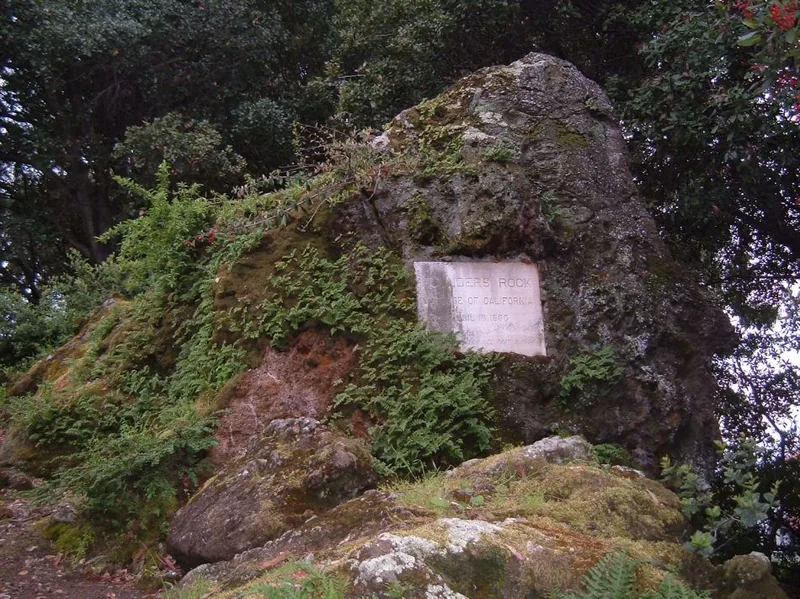
Founders' Rock is a massive natural outcropping at the northeastern corner of the University of California campus in Berkeley, where Hearst Avenue meets Gayley Road. A geology professor's statement describes it as silica-carbonate rock carried to the site and thrust upward by movement of the Hayward Fault, with no similar rock within 25 miles. On April 16, 1860, trustees of the College of California gathered at the rock to dedicate the campus site, and a witness praised the view toward the Golden Gate. In May 1866 trustees met there and chose the name Berkeley for the surrounding community. A plaque was dedicated by the class of 1896, and ceremonies were held at the rock on the fiftieth and one hundredth anniversaries of the university's founding. Although buildings such as the Greek Theater and Wheeler Hall have largely taken over ceremonial roles, the rock remains a link to the university's formative years and to the open landscape that preceded the campus.
Significance in brief: The nomination argues the rock is significant for its association with the founding of the University of California, when trustees of the College of California dedicated the campus site beside it in 1860. It has also hosted later commemorative events and serves as a symbol of the relationship between the natural and social environment at the Berkeley campus.
Machine-generated summary. This summary was generated by a language model from the official nomination document and has not been reviewed line by line by an editor. It may contain errors. Check the source document before relying on any detail. Source: nomination document (PDF) · National Archives catalog entry. NRHP reference 82004642, listed March 25, 1982. Summary generated October 2026 (model claude-sonnet-5-5, prompt v1.0-2026-10-29, confidence medium).
Key facts
| Address | Oxford St., Berkeley |
|---|---|
| County | Alameda County |
| Listed | March 25, 1982 |
| Reference number | 82004642 |
| Resource type | Site |
| Period of significance | 1800-1899 |
| Criteria |
|
| Areas of significance | Social History |
| Level of significance | National |
| Status (as stated in the nomination) | Condition is listed as excellent, unaltered and on its original site; large laboratory and classroom buildings now border it to the south and west. |
| Acreage | 0.2 |
| Coordinates | 37.88347, -122.25658 (NPS GIS) |
What listing means for this property
Sites (archaeological sites, battlefields, landscapes) are often listed with a restricted address to protect them from looting or disturbance. Listing is honorary for private owners; federal undertakings on or near the site go through Section 106 review, and state laws may protect burials and artefacts regardless of listing.
General information, not legal or tax advice. Rules change; confirm with your State Historic Preservation Office or a qualified adviser.
Sources and further reading
- National Park Service, National Register of Historic Places database (snapshot May 2026), reference 82004642.
- Nomination form (PDF, National Archives) — catalog entry
- Wikipedia article (used for cross-checking only; text not reproduced here)
- Wikidata Q5474591
- This listing as JSON
Last updated October 2026. Found an error? See the editorial policy for how to report it.