Roanoke Downtown Historic District

The pin is a point inside the NPS boundary polygon, not a surveyed location.
Why it's listed
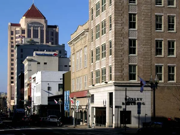
Downtown Roanoke's historic core covers 28 city blocks south of the railroad tracks, centered on South Jefferson Street and Campbell Avenue. The area developed rapidly after 1881, when the railroad chose Big Lick as a terminus; the town was renamed Roanoke in 1882 and became a city by 1884. Its streets hold banks, office towers, department stores, hotels, civic buildings and a Gothic Revival church, built from the late 19th century to the mid-20th century. Early brick commercial blocks in Italianate and Victorian styles give way to Neoclassical banks, a Beaux-Arts post office and courthouse, a Colonial Revival hotel, and Moderne and Art Deco towers. Architects include Edward G. Frye, John K. Peebles, Wyatt and Nolting, and William Lee Stoddard. Of 145 resources, 100 contribute to the district's character. It is recognized for architecture, commerce and government, reflecting the city's prosperity as a transportation and commercial hub for Southwest Virginia.
Significance in brief: The district is argued to be significant under Criteria A and C, at the local level, in architecture, commerce and politics/government. It grew from the railroad boom after 1881 and holds the city's financial, commercial and civic core. Its buildings show a wide range of styles, including work by well-known architects.
Machine-generated summary. This summary was generated by a language model from the official nomination document and has not been reviewed line by line by an editor. It may contain errors. Check the source document before relying on any detail. Source: nomination document (PDF) · National Archives catalog entry. NRHP reference 02000978, listed September 14, 2002. Summary generated October 2026 (model claude-sonnet-5-5, prompt v1.0-2026-10-29, confidence medium).
Key facts
| Address | Roughly bounded by 3rd St., Norfolk Ave., Jefferson St., and Bullitt Ave., Roanoke (Independent City) |
|---|---|
| County | Roanoke (city and county) |
| Listed | September 14, 2002 |
| Reference number | 02000978 |
| Resource type | District |
| Period of significance | 1882-1952 |
| Architect / builder | Edward G. Frye; Eubank and Caldwell; Aubrey Chesterman; Huggins and Barbour; Louis P. Smithey; Marcellus Wright; John K. Peebles; Wyatt and Nolting; William L. Stoddard |
| Architectural style | High Victorian Revival; Renaissance Beaux Arts; Classical Revival; Commercial Style; Moderne; Art Deco |
| Criteria |
|
| Areas of significance | Architecture, Commerce, Politics/Government |
| Level of significance | Local |
| Status (as stated in the nomination) | The district continues to serve as the business and governmental center of the city; most buildings are described as relatively intact, and some are non-contributing due to age or alterations. |
| Acreage | 46.6 |
| Within district | Roanoke Downtown Historic District (Boundary Increase) |
| Coordinates | 37.27046, -79.94306 (NPS GIS) |
What listing means for this property
This is a historic district. Buildings within its boundary are either contributing (they add to the district's significance) or non-contributing. Owners of contributing income-producing buildings can claim the 20% federal rehabilitation tax credit; homeowners should look at state credits. National Register districts impose no design review by themselves; a local historic district ordinance, if one exists, does (the difference explained).
General information, not legal or tax advice. Rules change; confirm with your State Historic Preservation Office or a qualified adviser.
Sources and further reading
- National Park Service, National Register of Historic Places database (snapshot May 2026), reference 02000978.
- Nomination form (PDF, National Archives) — catalog entry
- Wikipedia article (used for cross-checking only; text not reproduced here)
- Wikidata Q7339782
- This listing as JSON
Last updated October 2026. Found an error? See the editorial policy for how to report it.