Rosedale (Boundary Increase)
Also known as: See Also:Rosedale

Why it's listed
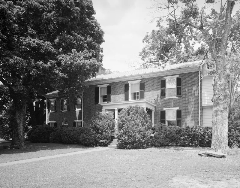
Rosedale, in Lynchburg, Virginia, is a historic property whose listed area was enlarged in 1992. The original nomination drew its boundaries too narrowly, so the agricultural and domestic outbuildings it described as significant fell outside the listed area. The Virginia Department of Historic Resources submitted an amendment at the owner's request, after review by the State Review Board. The amended boundary covers 84.15 acres, described as the acreage and outbuildings historically associated with Rosedale. The enlarged area counts seven contributing resources: six buildings and one site. The boundary is defined by six mapped points and runs roughly southeast, south, southwest, northwest, north and northeast around the tract. The increase was approved on April 10, 1992. The documents supplied for this amendment hold no description of the main house, its architect, its builder or its date of construction, so those details are not available here.
Significance in brief: The document does not give a statement of significance. The boundary amendment was filed because the original boundaries were too narrow and left out the agricultural and domestic outbuildings that the original nomination called significant.
Machine-generated summary. This summary was generated by a language model from the official nomination document and has not been reviewed line by line by an editor. It may contain errors. Check the source document before relying on any detail. Source: nomination document (PDF) · National Archives catalog entry. NRHP reference 92000240, listed April 10, 1992. Summary generated October 2026 (model claude-sonnet-5-5, prompt v1.0-2026-10-29, confidence low).
Key facts
| Address | Graves Mill Rd. W of jct. with VA 291, Lynchburg (Independent City) |
|---|---|
| County | Lynchburg |
| Listed | April 10, 1992 |
| Reference number | 92000240 |
| Resource type | Building |
| Areas of significance | Exploration/Settlement, Architecture |
| Level of significance | State |
| Acreage | 61.7 |
| Coordinates | 37.37707, -79.23161 (NPS GIS) |
What listing means for this property
National Register listing is honorary: it recognises significance and does not restrict what a private owner may do without federal money or permits. It unlocks the 20% federal rehabilitation tax credit for income-producing buildings, state credits in many states, and Section 106 review when federal agencies are involved. See what listing means in practice.
General information, not legal or tax advice. Rules change; confirm with your State Historic Preservation Office or a qualified adviser.
Sources and further reading
- National Park Service, National Register of Historic Places database (snapshot May 2026), reference 92000240.
- Nomination form (PDF, National Archives) — catalog entry
- Wikipedia article (used for cross-checking only; text not reproduced here)
- Wikidata Q7368157
- This listing as JSON
Last updated October 2026. Found an error? See the editorial policy for how to report it.