Lexington and Covington Turnpike Toll House
Also known as: VDHR file no. 117-0042

Why it's listed
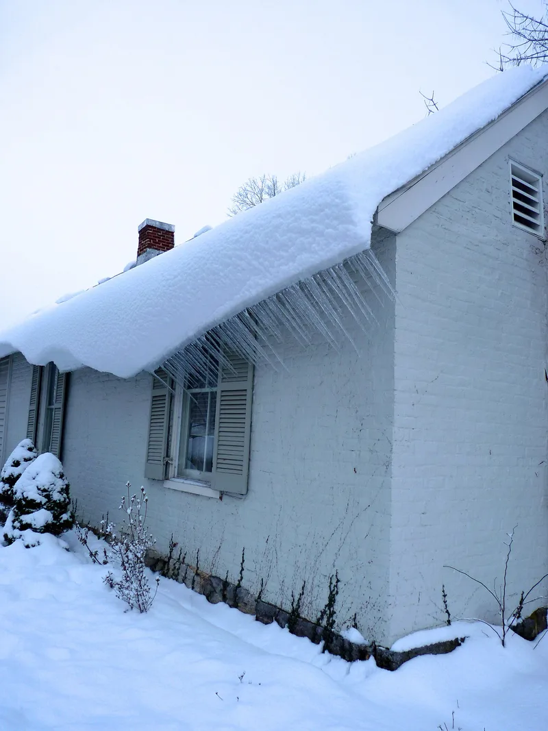
Standing on a 0.39-acre lot at the corner of Lime Kiln Road and Enfield Road in Lexington, Virginia, this small house began as a two-room brick toll house built about 1834 for the Lexington & Covington Turnpike. It has a Flemish-bond front, a molded brick cornice and gable-end chimneys. Later owners added a board-and-batten frame ell in 1865-67, two plank-built rooms in the early 1870s, a Victorian porch possibly in 1887, weatherboard siding and a rear addition in the early twentieth century. Turnpike records name early toll keepers, who were paid with the use of the house and lot plus a share of collections. The company fell into debt and sold the road and four toll houses in 1855. The house deteriorated badly in the later twentieth century, then was stabilized and rehabilitated between 1997 and 2004. A ruined spring house on the lot is also counted as a contributing resource.
Significance in brief: The house is a surviving toll house from an early nineteenth-century turnpike that local leaders hoped would become part of a major east-west route. Its fabric records a sequence of additions from the 1860s to the early twentieth century. The form's section 8 and the criteria boxes are not fully legible in the supplied text, so the full basis of significance is only partly visible.
Machine-generated summary. This summary was generated by a language model from the official nomination document and has not been reviewed line by line by an editor. It may contain errors. Check the source document before relying on any detail. Source: nomination document (PDF) · National Archives catalog entry. NRHP reference 04001268, listed November 27, 2004. Summary generated October 2026 (model claude-sonnet-5-5, prompt v1.0-2026-10-29, confidence medium).
Key facts
| Address | 453 Lime Kiln Rd., Lexington |
|---|---|
| County | Lexington |
| Listed | November 27, 2004 |
| Reference number | 04001268 |
| Resource type | Building |
| Architectural style | Federal; Victorian |
| Areas of significance | Transportation, Architecture |
| Level of significance | Local |
| Status (as stated in the nomination) | Severely deteriorated in the second half of the twentieth century; stabilized and partly rehabilitated 1997-2004, with rehabilitation under the Secretary's Standards beginning in winter 2004. Historic and current function is listed as single dwelling. |
| Acreage | 0.4 |
| Coordinates | 37.78666, -79.45415 (NPS GIS) |
What listing means for this property
National Register listing is honorary for a privately owned home: it does not by itself restrict what an owner may do with their own money, and it does not require public access. Restrictions come from local landmark or historic-district ordinances, which are separate (how they differ).
Owner-occupied houses are not eligible for the 20% federal rehabilitation tax credit, which applies to income-producing buildings, but many states offer credits for homeowners. Listing also opens the door to preservation easements and to buying a plaque. Start with what listing means for homeowners, renovating a listed house and selling one.
General information, not legal or tax advice. Rules change; confirm with your State Historic Preservation Office or a qualified adviser.
Sources and further reading
- National Park Service, National Register of Historic Places database (snapshot May 2026), reference 04001268.
- Nomination form (PDF, National Archives) — catalog entry
- Wikipedia article (used for cross-checking only; text not reproduced here)
- Wikidata Q16894137
- This listing as JSON
Last updated October 2026. Found an error? See the editorial policy for how to report it.