Hampton Downtown Historic District
Also known as: 114-5445

Why it's listed
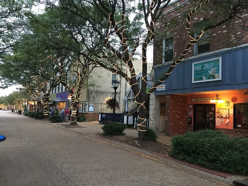
Downtown Hampton, Virginia, grew from a port town whose cross-shaped street plan, formed by King and Queen Streets, was laid out in 1691. The historic district covers about 26 acres and holds 43 primary resources, 34 of them contributing to its character. Most buildings are brick or masonry commercial structures from the late nineteenth to mid-twentieth century, rebuilt after Confederate forces burned the city in 1861 and a second fire struck in 1884. Notable landmarks include St. John's Episcopal Church, whose walls date to 1728, the 1876 courthouse, the 1883 Hampton Baptist Church, a 1914 post office and the Art Deco former City Hall of 1938. Archaeological sites beneath the streets and buildings preserve evidence of wells, taverns and dwellings from the colonial era. The district was recognized for archaeology, architecture, commerce and community planning, covering the years 1691 to 1952, and it keeps its original street layout despite later infill and redevelopment.
Significance in brief: The district keeps the 1691 town plan and a collection of buildings and archaeological sites showing Hampton's development from a colonial port to a modern city's downtown. Most buildings date from after the 1861 burning of the city and an 1884 fire. It is significant locally for archaeology, architecture, commerce, and community planning and development.
Machine-generated summary. This summary was generated by a language model from the official nomination document and has not been reviewed line by line by an editor. It may contain errors. Check the source document before relying on any detail. Source: nomination document (PDF) · National Archives catalog entry. NRHP reference 10001062, listed December 28, 2010. Summary generated October 2026 (model claude-sonnet-5-5, prompt v1.0-2026-10-29, confidence medium).
Key facts
| Address | Roughly bounded by Franklin St, Lincoln St, Settlers Landing Rd, Eaton St, Hampton |
|---|---|
| County | Hampton |
| Listed | December 28, 2010 |
| Reference number | 10001062 |
| Resource type | District |
| Period of significance | 1691-1952 |
| Architect / builder | Oscar Wenderoth (post office); Charles T. Holtzclaw (St. Tammany's Masonic Lodge, Hampton Baptist Church); Williams, Coile and Pipino (former City Hall); Muirhead Contracting Company (City Hall contractor) |
| Architectural style | Colonial; Late Victorian: Second Gothic Revival; Beaux Arts; Commercial Style; Art Deco |
| Criteria |
|
| Areas of significance | Architecture, Community Planning and Development, Historic - Non-Aboriginal, Commerce |
| Level of significance | Local |
| Status (as stated in the nomination) | Fully developed with only a few vacant lots; recent city and private efforts focus on downtown revitalization and renovation of historic buildings. The former City Hall was converted to apartments in 2006. |
| Acreage | 26 |
| Coordinates | 37.02640, -76.34486 (NPS GIS) |
What listing means for this property
This is a historic district. Buildings within its boundary are either contributing (they add to the district's significance) or non-contributing. Owners of contributing income-producing buildings can claim the 20% federal rehabilitation tax credit; homeowners should look at state credits. National Register districts impose no design review by themselves; a local historic district ordinance, if one exists, does (the difference explained).
General information, not legal or tax advice. Rules change; confirm with your State Historic Preservation Office or a qualified adviser.
Sources and further reading
- National Park Service, National Register of Historic Places database (snapshot May 2026), reference 10001062.
- Nomination form (PDF, National Archives) — catalog entry
- Wikipedia article (used for cross-checking only; text not reproduced here)
- Wikidata Q15222688
- This listing as JSON
Last updated October 2026. Found an error? See the editorial policy for how to report it.