"A" Fort and Battery Hill Redoubt-Camp Early
Also known as: Measles Fort; 44fx506; 44fx529

Why it's listed
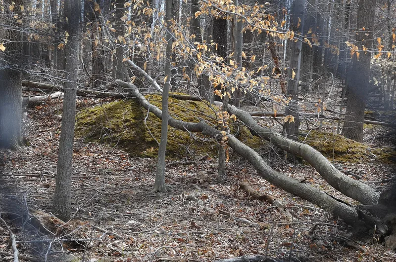
Two Confederate earthworks on a wooded plateau near Union Mills, Fairfax County, preserve the military landscape of Camp Early. The larger fort, shaped like an A, measures about 550 by 500 feet and has five cannon embrasures at its apex. About 1,200 feet south, a square redoubt has nine embrasures. Nearby are traces of 156 tent platforms, latrine trenches, a well and house remains. Confederate troops under General Joseph E. Johnston built the works in the winter of 1861-1862 as part of the defenses of Manassas, and units under General Jubal Early occupied the camp. The army withdrew in March 1862, but the line had delayed a renewed Union advance. In October 1863 Union artillery used the Battery Hill Redoubt to drive back Confederate cavalry attacking McClean's Ford. These are the last surviving works built by the Confederate Army of the Potomac in the county, and they hold archaeological evidence of early war engineering and camp life, despite damage from relic hunting and erosion.
Significance in brief: The fortifications were part of the Confederate defensive line protecting Manassas after the First Battle of Manassas, and are the last remaining works built by the Confederate Army of the Potomac in Fairfax County. The redoubt was also used in combat in October 1863. The site holds archaeological potential on early Confederate field engineering and camp layout.
Machine-generated summary. This summary was generated by a language model from the official nomination document and has not been reviewed line by line by an editor. It may contain errors. Check the source document before relying on any detail. Source: nomination document (PDF) · National Archives catalog entry. NRHP reference 98001315, listed October 30, 1998. Summary generated October 2026 (model claude-sonnet-5-5, prompt v1.0-2026-10-29, confidence high).
Key facts
| Address | Balmoral Greens Ave., 1 mi S. of jct. with Compton Rd., Manassas Park |
|---|---|
| County | Fairfax (city and county) |
| Listed | October 30, 1998 |
| Reference number | 98001315 |
| Resource type | Site |
| Period of significance | 1861-1865 |
| Criteria |
|
| Areas of significance | Military |
| Level of significance | State |
| Status (as stated in the nomination) | Covered by secondary forest; damaged by erosion, relic hunting and off-road vehicle traffic. |
| Acreage | 25 |
| Coordinates | 38.78981, -77.42767 (NPS GIS) |
What listing means for this property
Sites (archaeological sites, battlefields, landscapes) are often listed with a restricted address to protect them from looting or disturbance. Listing is honorary for private owners; federal undertakings on or near the site go through Section 106 review, and state laws may protect burials and artefacts regardless of listing.
General information, not legal or tax advice. Rules change; confirm with your State Historic Preservation Office or a qualified adviser.
Sources and further reading
- National Park Service, National Register of Historic Places database (snapshot May 2026), reference 98001315.
- Nomination form (PDF, National Archives) — catalog entry
- Wikipedia article (used for cross-checking only; text not reproduced here)
- Wikidata Q14560090
- This listing as JSON
Last updated October 2026. Found an error? See the editorial policy for how to report it.