Town of Bermuda Hundred Historic District
Also known as: 020-0064

Why it's listed
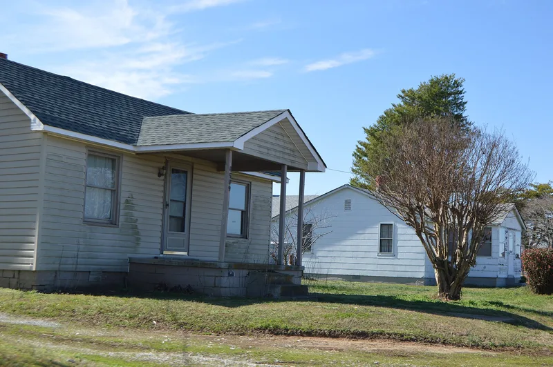
Bermuda Hundred is a quiet village of about 16 acres where Bermuda Hundred Road meets the James River in Chesterfield County. Settlement began around 1613, and the town later served as a market, a slave market, and the official Virginia and federal port of entry in the late 1700s. Steamboat wharfs once lined the waterfront but have rotted away. Today the district contains houses with outbuildings, a Baptist church founded in 1850 by the African-American members of a divided congregation, an early 20th-century schoolhouse for Black children, a cemetery, and one excavated archaeological site. The Bishop-Johnson House, tied to merchants including the free Black merchant Archibald Batte, sits beside an excavated store site. Union troops occupied the peninsula in 1864, leaving camp remains. Unrecorded archaeological deposits are likely beneath the village and in nearby fields. The district was listed for its history in agriculture, commerce and archaeology.
Significance in brief: The district is argued to be significant for its long history as a colonial town, port of entry, slave market and later a free African-American enclave and Civil War Union supply station. Its standing buildings and buried remains also hold information on commerce, agriculture and settlement from the 17th to the 20th century.
Machine-generated summary. This summary was generated by a language model from the official nomination document and has not been reviewed line by line by an editor. It may contain errors. Check the source document before relying on any detail. Source: nomination document (PDF) · National Archives catalog entry. NRHP reference 06001011, listed November 8, 2006. Summary generated October 2026 (model claude-sonnet-5-5, prompt v1.0-2026-10-29, confidence medium).
Key facts
| Address | Both sides of Bermuda Hundred and Allied Rds., Chester |
|---|---|
| County | Chesterfield County |
| Listed | November 8, 2006 |
| Reference number | 06001011 |
| Resource type | District |
| Period of significance | ca. 1613 to 1940 |
| Architectural style | Mid-19th Century; Late 19th and 20th Century (includes Greek Revival church) |
| Criteria |
|
| Areas of significance | Agriculture, Historic - Non-Aboriginal |
| Level of significance | Local |
| Status (as stated in the nomination) | The former schoolhouse is derelict and abandoned; most other buildings are in use as dwellings. The wharfs have rotted away. |
| Acreage | 16.2 |
| Coordinates | 37.34176, -77.27196 (NPS GIS) |
What listing means for this property
This is a historic district. Buildings within its boundary are either contributing (they add to the district's significance) or non-contributing. Owners of contributing income-producing buildings can claim the 20% federal rehabilitation tax credit; homeowners should look at state credits. National Register districts impose no design review by themselves; a local historic district ordinance, if one exists, does (the difference explained).
General information, not legal or tax advice. Rules change; confirm with your State Historic Preservation Office or a qualified adviser.
Sources and further reading
- National Park Service, National Register of Historic Places database (snapshot May 2026), reference 06001011.
- Nomination form (PDF, National Archives) — catalog entry
- Wikipedia article (used for cross-checking only; text not reproduced here)
- Wikidata Q4892627
- This listing as JSON
Last updated October 2026. Found an error? See the editorial policy for how to report it.