Fincastle Historic District

Why it's listed
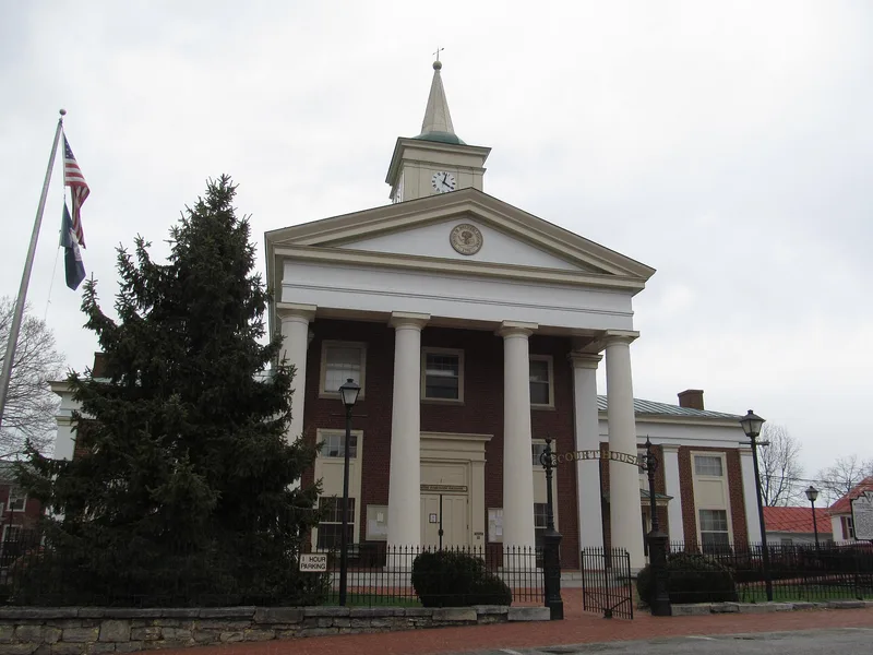
Fincastle is a small county-seat town in Botetourt County, Virginia, laid out in 1770 by County Surveyor William Preston and established by the Virginia Assembly in 1772. It began as a frontier village and was among the last outposts for pioneers heading west through the Valley of Virginia. The nominated district of about 85 acres keeps the look of a nineteenth-century agricultural community. Its skyline is still marked by three church spires and the court house cupola. The 1845 court house is a Roman Revival building of red brick and whitewashed stucco, and local tradition links it to plans by Jefferson. Greek Revival churches, the 1837 Gothic Revival St. Mark's Episcopal Church, a late Victorian jail, and houses such as the log Peck House, the Federal Ammen House and the Kyle House add variety. Local materials and a consistent scale unify the town. Later documentation adds its role as a supply point for westward settlers and its ties to Lewis and Clark.
Significance in brief: The district is an excellent example of a small nineteenth-century agricultural town, with its early architecture, skyline and street plan little changed. It began as a colonial frontier village and was one of the last outposts for pioneers moving west. Later documentation adds its role as a supply point and its links to the Lewis and Clark expedition.
Machine-generated summary. This summary was generated by a language model from the official nomination document and has not been reviewed line by line by an editor. It may contain errors. Check the source document before relying on any detail. Source: nomination document (PDF) · National Archives catalog entry. NRHP reference 69000224, listed November 12, 1969. Summary generated October 2026 (model claude-sonnet-5-5, prompt v1.0-2026-10-29, confidence medium).
Key facts
| Address | Roughly bounded by Carper, Hancock, Catawba, and Back Sts., and Griffin Alley, Fincastle |
|---|---|
| County | Botetourt County |
| Listed | November 12, 1969 |
| Reference number | 69000224 |
| Resource type | District |
| Architect / builder | Town laid out by County Surveyor William Preston (1770); court house said by local tradition to follow plans submitted by Mr. Jefferson |
| Architectural style | Roman Revival, Greek Revival, Gothic Revival, Federal and late Victorian |
| Areas of significance | Community Planning and Development, Commerce, Architecture, Exploration/Settlement, Agriculture |
| Level of significance | State |
| Status (as stated in the nomination) | Condition rated good; nearly all early buildings are little altered and well maintained. The district is occupied and includes private residences, commercial uses and a village setting. |
| Coordinates | 37.49879, -79.87578 (NPS GIS) |
What listing means for this property
This is a historic district. Buildings within its boundary are either contributing (they add to the district's significance) or non-contributing. Owners of contributing income-producing buildings can claim the 20% federal rehabilitation tax credit; homeowners should look at state credits. National Register districts impose no design review by themselves; a local historic district ordinance, if one exists, does (the difference explained).
General information, not legal or tax advice. Rules change; confirm with your State Historic Preservation Office or a qualified adviser.
Sources and further reading
- National Park Service, National Register of Historic Places database (snapshot May 2026), reference 69000224.
- Nomination form (PDF, National Archives) — catalog entry
- Wikipedia article (used for cross-checking only; text not reproduced here)
- Wikidata Q16836820
- This listing as JSON
Last updated October 2026. Found an error? See the editorial policy for how to report it.