Fort C. F. Smith Historic District
Also known as: Fort C.F. Smith Park; DHR File No. 0005079, Archeology No. AR31

Why it's listed
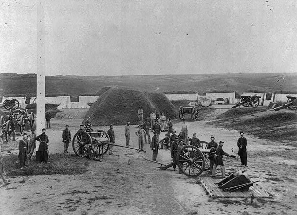
Fort C.F. Smith Park in Arlington, Virginia, covers 19 acres on a bluff overlooking the Potomac River and Spout Run. It preserves the earthworks of a Civil War fort that was occupied from 1863 to 1865 and built mid-war to strengthen the defenses of Washington. The fort was a lunette with two faces and two flanks, and its bastions on the north flank are an unusual feature for that type of work. After the army dismantled the fort in the fall of 1865, the land returned to the Jewell family and later became a private estate. The estate's main house combines Gothic Revival, Stick, Queen Anne, Shingle, Craftsman and Colonial Revival elements, and the grounds include gardens and a vista toward Georgetown. The ruins were integrated into the landscape rather than reshaped, which helped protect them. The district is listed for its military history and for archaeological deposits from the Woodland period to the twentieth century.
Significance in brief: The nomination argues the fort is a significant Civil War defensive work built mid-war to strengthen the defenses of Washington. Its unusual features include bastions on a lunette, and its earthworks survive largely intact. The park also contains archaeological deposits dating from the Woodland period to the twentieth century that have yielded or may yield historical information.
Machine-generated summary. This summary was generated by a language model from the official nomination document and has not been reviewed line by line by an editor. It may contain errors. Check the source document before relying on any detail. Source: nomination document (PDF) · National Archives catalog entry. NRHP reference 99001719, listed February 1, 2000. Summary generated October 2026 (model claude-sonnet-5-5, prompt v1.0-2026-10-29, confidence medium).
Key facts
| Address | 2411 24th St., Arlington |
|---|---|
| County | Arlington County |
| Listed | February 1, 2000 |
| Reference number | 99001719 |
| Resource type | District |
| Period of significance | 1863-1865 |
| Architectural style | Mixed |
| Criteria |
|
| Areas of significance | Military, Historic - Non-Aboriginal |
| Level of significance | National |
| Status (as stated in the nomination) | Now a county park used for recreation. Earthworks are described as intact and in very good condition. The small barn is in an advanced state of dilapidation. |
| Acreage | 19 |
| Coordinates | 38.90148, -77.08968 (NPS GIS) |
What listing means for this property
This is a historic district. Buildings within its boundary are either contributing (they add to the district's significance) or non-contributing. Owners of contributing income-producing buildings can claim the 20% federal rehabilitation tax credit; homeowners should look at state credits. National Register districts impose no design review by themselves; a local historic district ordinance, if one exists, does (the difference explained).
General information, not legal or tax advice. Rules change; confirm with your State Historic Preservation Office or a qualified adviser.
Sources and further reading
- National Park Service, National Register of Historic Places database (snapshot May 2026), reference 99001719.
- Nomination form (PDF, National Archives) — catalog entry
- Wikipedia article (used for cross-checking only; text not reproduced here)
- Wikidata Q5470877
- This listing as JSON
Last updated October 2026. Found an error? See the editorial policy for how to report it.