Barrio Azteca Historic District
Also known as: El Azteca; El Ranchero

Why it's listed
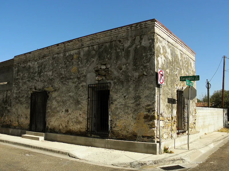
Barrio Azteca is a 53-block neighborhood of Laredo, Texas, east of the old downtown on a high bluff above the Rio Grande. It combines two older communities, El Ranchero along the river and El Azteca to the north, and contains 306 contributing and 247 noncontributing properties. The oldest surviving buildings are mid-nineteenth-century, one-story stone houses with flat roofs, followed by brick commercial and domestic buildings from the 1880s, when local brickmaking and the arrival of the railroad drove rapid growth. Later houses show Queen Anne, Classical Revival and Craftsman influence, and many stand close to the street with little setback. Arrivals fleeing the Mexican Revolution added many homes and businesses after 1910. The district matters because it preserves a blend of Mexican and American building traditions peculiar to the lower Rio Grande border, and because its relative isolation from highways and the international bridge limited redevelopment. Modern infill and possible border station expansion remain concerns.
Significance in brief: The district retains a wide range of vernacular stone, brick and frame buildings that blend Mexican and Anglo-American building traditions found only along the lower Rio Grande border. Few communities in the region keep their historic character and integrity to such a degree. The form also ties its growth to Laredo's Spanish colonial founding in 1755, the arrival of the railroad in 1881, and the influx of refugees from the Mexican Revolution.
Machine-generated summary. This summary was generated by a language model from the official nomination document and has not been reviewed line by line by an editor. It may contain errors. Check the source document before relying on any detail. Source: nomination document (PDF) · National Archives catalog entry. NRHP reference 03000431, listed May 21, 2003. Summary generated October 2026 (model claude-sonnet-5-5, prompt v1.0-2026-10-29, confidence medium).
Key facts
| Address | Roughly bounded by I-35, Matamoros St., Arroyo Zacate, and the Rio Grande, Laredo |
|---|---|
| County | Webb County |
| Listed | May 21, 2003 |
| Reference number | 03000431 |
| Resource type | District |
| Architectural style | No Style; Late 19th and 20th Century Revival: Mission/Spanish Colonial Revival; 1-part and 2-part commercial block; Mexican Vernacular |
| Areas of significance | Architecture, Community Planning and Development, Hispanic |
| Level of significance | Local |
| Status (as stated in the nomination) | Current functions are domestic, commercial and governmental; the form notes some modern alterations, infill and demolition of older buildings. |
| Acreage | 120 |
| Coordinates | 27.50197, -99.49784 (NPS GIS) |
What listing means for this property
This is a historic district. Buildings within its boundary are either contributing (they add to the district's significance) or non-contributing. Owners of contributing income-producing buildings can claim the 20% federal rehabilitation tax credit; homeowners should look at state credits. National Register districts impose no design review by themselves; a local historic district ordinance, if one exists, does (the difference explained).
General information, not legal or tax advice. Rules change; confirm with your State Historic Preservation Office or a qualified adviser.
Sources and further reading
- National Park Service, National Register of Historic Places database (snapshot May 2026), reference 03000431.
- Nomination form (PDF, National Archives) — catalog entry
- Wikipedia article (used for cross-checking only; text not reproduced here)
- Wikidata Q4863710
- This listing as JSON
Last updated October 2026. Found an error? See the editorial policy for how to report it.