Frankford Avenue Bridge
Why it's listed
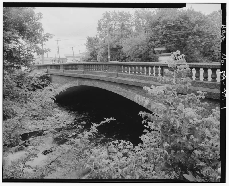
Stone arch bridge crossing Pennypack Creek in Philadelphia, with three semi-circular masonry arches supported by rubble stone piers. The bridge formed part of the Kings Road, the route that eventually connected Philadelphia with New York. Local male residents of what was then Lower Dublin Township are said to have built it, paying either labor or money toward its construction. The road was paved in 1803 when it became part of the Frankford and Bristol Turnpike toll road. It was widened and reinforced in 1893, after which trolley tracks and automobiles crossed it. The original arches remain intact despite these changes. The nomination regards it as possibly the oldest stone arch bridge still carrying a modern highway in America, and its significance rests on engineering and transportation.
Significance in brief: The nomination states the bridge is thought to be the oldest stone arch bridge still carrying a modern highway in America. It was an important link in the Kings Road, which eventually connected Philadelphia to New York. The three semi-circular arches are original and are well buttressed with rubble stone piers, and the nomination argues its engineering and transportation importance.
Machine-generated summary. This summary was generated by a language model from the official nomination document and has not been reviewed line by line by an editor. It may contain errors. Check the source document before relying on any detail. Source: nomination document (PDF) · National Archives catalog entry. NRHP reference 88000850, listed June 22, 1988. Summary generated October 2026 (model claude-haiku-5-5, prompt v1.1-2026-10-29, confidence medium).
Key facts
| Address | Frankford Ave. over Poquessing Creek, Philadelphia |
|---|---|
| County | Philadelphia |
| Listed | June 22, 1988 |
| Reference number | 88000850 |
| Resource type | Structure |
| Architectural style | Semi-circular masonry arch |
| Areas of significance | Engineering, Transportation |
| Level of significance | State |
| Status (as stated in the nomination) | Widened and reinforced in 1893 and later fitted with guard rail and sidewalk; still carrying traffic according to the statement of significance. |
| Acreage | 0.9 |
| Coordinates | 40.04365, -75.02048 (NPS GIS) |
What listing means for this property
For a publicly owned building or structure, listing mainly matters when federal funds, permits or licences are involved: projects then go through Section 106 review so effects on the property are considered. Listing also strengthens applications for preservation grants and, for leased income-producing uses, can enable the federal rehabilitation tax credit.
General information, not legal or tax advice. Rules change; confirm with your State Historic Preservation Office or a qualified adviser.
Sources and further reading
- National Park Service, National Register of Historic Places database (snapshot May 2026), reference 88000850.
- Nomination form (PDF, National Archives) — catalog entry
- Wikipedia article (used for cross-checking only; text not reproduced here)
- Wikidata Q7229867
- This listing as JSON
Last updated October 2026. Found an error? See the editorial policy for how to report it.