South Bethlehem Downtown Historic District

Why it's listed
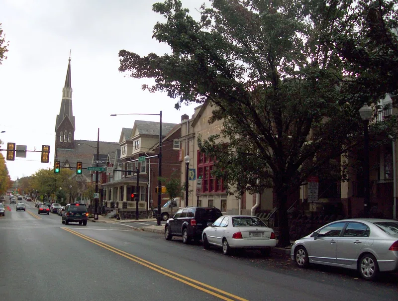
Two- to four-story brick commercial blocks line 3rd, 4th, Wyandotte and New streets in the South Bethlehem downtown, built mostly between about 1900 and 1935 on a grid laid out in the 1850s. The district holds 288 contributing buildings, with storefronts altered into the 1940s, while upper floors and cornices often remain largely intact. Early examples include the Italianate row known as Palace Row on Wyandotte Street, completed by 1877, and the Liberty Hose No. 1 of 1885 with corbelled brick, pressed metal cornice and terra cotta. Its importance rests on the district's role as the commercial and civic center of a community whose population grew from 3,556 in 1870 to 19,973 in 1910, largely through workers drawn to Bethlehem Steel. Business directories from 1890 and 1900 show dense retail, hotel and trade activity within its boundaries. Its streetscape illustrates the two-part commercial block form that dominated Victorian-era downtowns.
Significance in brief: The district is argued to have been the commercial and civic core of South Bethlehem, serving the growing industrial community shaped by Bethlehem Steel and Lehigh University. Its concentration of two- to four-story commercial blocks and vernacular and high-style buildings from the Late Victorian era through the 1920s is presented as representative of the period's downtown architecture.
Machine-generated summary. This summary was generated by a language model from the official nomination document and has not been reviewed line by line by an editor. It may contain errors. Check the source document before relying on any detail. Source: nomination document (PDF) · National Archives catalog entry. NRHP reference 05001500, listed January 3, 2006. Summary generated October 2026 (model claude-haiku-5-5, prompt v1.1-2026-10-29, confidence high).
Key facts
| Address | Roughly bounded by Wyandotte, Columbia, Hayes, and Morton St., Bethlehem |
|---|---|
| County | Northampton County |
| Listed | January 3, 2006 |
| Reference number | 05001500 |
| Resource type | District |
| Period of significance | 1874-1955 |
| Architectural style | Late Victorian; Italianate, Second Empire, Romanesque, Queen Anne; Beaux Arts, Moderne, Mediterranean Revival |
| Criteria |
|
| Areas of significance | Commerce, Architecture |
| Level of significance | Local |
| Acreage | 74 |
| Coordinates | 40.61279, -75.37452 (NPS GIS) |
What listing means for this property
This is a historic district. Buildings within its boundary are either contributing (they add to the district's significance) or non-contributing. Owners of contributing income-producing buildings can claim the 20% federal rehabilitation tax credit; homeowners should look at state credits. National Register districts impose no design review by themselves; a local historic district ordinance, if one exists, does (the difference explained).
General information, not legal or tax advice. Rules change; confirm with your State Historic Preservation Office or a qualified adviser.
Sources and further reading
- National Park Service, National Register of Historic Places database (snapshot May 2026), reference 05001500.
- Nomination form (PDF, National Archives) — catalog entry
- Wikipedia article (used for cross-checking only; text not reproduced here)
- Wikidata Q7566326
- This listing as JSON
Last updated October 2026. Found an error? See the editorial policy for how to report it.