Farmar Mill
Also known as: Mather Mill

Approximate location: the National Park Service places this pin arbitrarily within the property, not at a surveyed point (stated accuracy ±12 m).
Why it's listed
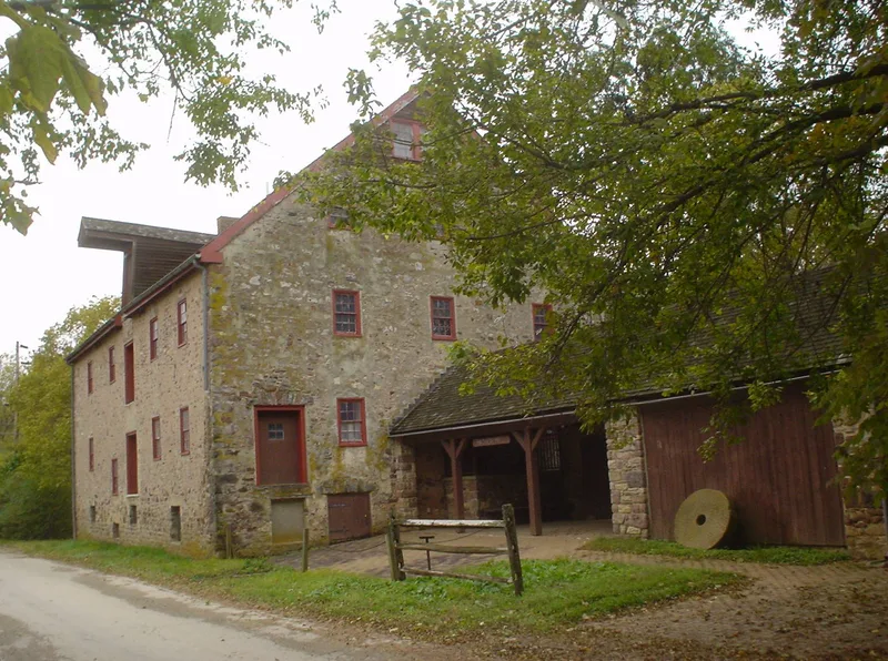
Farmar's Mill is a three-story grist mill of dressed fieldstone with a gabled roof that extends below the second-story windows, standing beside the Wissahickon Creek in Fort Washington, Montgomery County. It was built on land within a 5000-acre tract purchased from William Penn in 1683 by Jasper Farmar, a British Army major who died before emigrating. His widow Mary and son Edward inherited the acreage, and the family arrived in Philadelphia in 1685. Farmar built the stone mill between 1685 and 1700, and it operated for roughly two centuries. The mill is significant for its early construction, its long working life, and its association with Farmar, who became an interpreter at Peace Councils held with local Indians. The building has been enlarged since it was first constructed and remains on its original site.
Significance in brief: The nomination argues the mill is significant as an early stone grist mill associated with Jasper Farmar, an early settler of the Whitemarsh area, who is said to have served as an interpreter at Peace Councils held with local Indians. The mill is described as having remained in operation for approximately 200 years.
Machine-generated summary. This summary was generated by a language model from the official nomination document and has not been reviewed line by line by an editor. It may contain errors. Check the source document before relying on any detail. Source: nomination document (PDF) · National Archives catalog entry. NRHP reference 72001140, listed May 19, 1972. Summary generated October 2026 (model claude-haiku-5-5, prompt v1.1-2026-10-29, confidence medium).
Key facts
| Address | N of Flourtown at jct. of U.S. 309 and PA 73, Fort Washington |
|---|---|
| County | Montgomery County |
| Listed | May 19, 1972 |
| Reference number | 72001140 |
| Resource type | Building |
| Period of significance | 1685-1700 |
| Criteria |
|
| Areas of significance | Industry, Commerce, Military, Agriculture |
| Level of significance | National |
| Status (as stated in the nomination) | Condition is marked fair and the structure is marked unaltered with its original site retained, though it has been enlarged over time. |
| Acreage | 3.2 |
| Coordinates | 40.12399, -75.21897 (NPS GIS) |
What listing means for this property
For an income-producing building, listing (individually or as a contributing building in a district) is the gateway to the 20% federal rehabilitation tax credit on qualified rehabilitation costs, often stackable with state credits. Work claiming the credit must follow the Secretary of the Interior's Standards and be approved in advance.
Listing does not restrict a private owner acting without federal money or permits; where federal funding or licensing is involved, Section 106 review applies.
General information, not legal or tax advice. Rules change; confirm with your State Historic Preservation Office or a qualified adviser.
Sources and further reading
- National Park Service, National Register of Historic Places database (snapshot May 2026), reference 72001140.
- Nomination form (PDF, National Archives) — catalog entry
- Wikipedia article (used for cross-checking only; text not reproduced here)
- Wikidata Q526926
- This listing as JSON
Last updated October 2026. Found an error? See the editorial policy for how to report it.