Cold Point Historic District
Also known as: 0425732869

Why it's listed
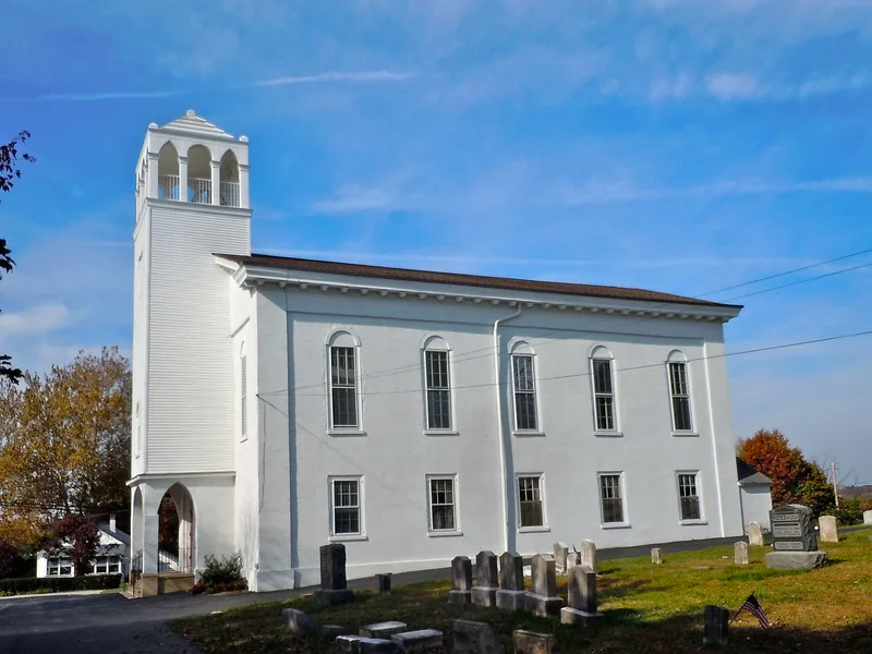
Cold Point is a rural village and farming district in Plymouth and Whitemarsh Townships, Montgomery County, Pennsylvania, lying east of the Plymouth Meeting area along Butler Pike. Its houses are mainly two-and-a-half-story rubble stone dwellings, stuccoed, with gabled roofs, many built between about 1745 and 1878. Limestone deposits supported lime burning from the early 1700s, and by the 1840s the Corson family had built a lime business that became one of the oldest continuously operated lime companies in the country. The village also holds the Cold Point Baptist Church, its burial ground on Cold Point Hill, and the Cold Point School, built in 1817 on land given by Thomas Egbert. Free black landowners lived in the village, and the district is important for its surviving 19th-century fabric and rural character. On May 20, 1778, a British force under General Grant marched past Cold Point Hill during the Revolutionary War.
Significance in brief: The nomination argues the district preserves the character of a nineteenth-century rural and early industrial community, centred on the lime industry and the Corson family's lime business. It also cites the Cold Point Baptist Church, the Cold Point School, the early ownership of property by free black men, and the 1778 British march past Cold Point Hill during the Revolutionary War.
Machine-generated summary. This summary was generated by a language model from the official nomination document and has not been reviewed line by line by an editor. It may contain errors. Check the source document before relying on any detail. Source: nomination document (PDF) · National Archives catalog entry. NRHP reference 83002261, listed September 9, 1983. Summary generated October 2026 (model claude-haiku-5-5, prompt v1.1-2026-10-29, confidence medium).
Key facts
| Address | I-276, Butler Pike, Militia Hill and Narcissa Rds., Norristown |
|---|---|
| County | Montgomery County |
| Listed | September 9, 1983 |
| Reference number | 83002261 |
| Resource type | District |
| Areas of significance | Industry, Architecture, Agriculture |
| Level of significance | Local |
| Status (as stated in the nomination) | Approximately 91% of the houses shown on Scott's 1877 Atlas are still standing, according to the document. |
| Acreage | 157 |
| Coordinates | 40.11668, -75.26652 (NPS GIS) |
What listing means for this property
This is a historic district. Buildings within its boundary are either contributing (they add to the district's significance) or non-contributing. Owners of contributing income-producing buildings can claim the 20% federal rehabilitation tax credit; homeowners should look at state credits. National Register districts impose no design review by themselves; a local historic district ordinance, if one exists, does (the difference explained).
General information, not legal or tax advice. Rules change; confirm with your State Historic Preservation Office or a qualified adviser.
Sources and further reading
- National Park Service, National Register of Historic Places database (snapshot May 2026), reference 83002261.
- Nomination form (PDF, National Archives) — catalog entry
- Wikipedia article (used for cross-checking only; text not reproduced here)
- Wikidata Q5142314
- This listing as JSON
Last updated October 2026. Found an error? See the editorial policy for how to report it.