Crook Farm

Why it's listed
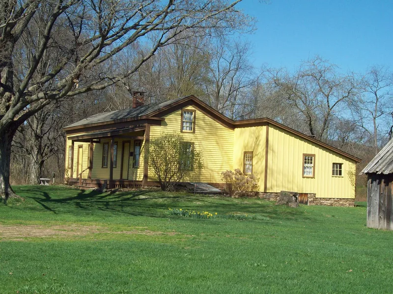
Built in 1856 in Bradford, McKean County, Pennsylvania, the Crook Farmhouse began as a two-room dwelling and was enlarged soon after to about 43 by 30 feet, with a shed addition at one end. Its frame is an unusual post and beam skeleton fitted with thin board curtain walls, and it combines horizontal clapboard with vertical board and batten siding. The farm is regarded as the oldest existing structure in the area, predating the discovery of oil in the Bradford field by about fifteen years. On the property the Olmstead Well, drilled in the Bradford Oil Field, was one of the first large producing wells and was noted as one of the heaviest early producers, yielding 100 to 125 barrels a day for about twenty years. The Crook family combined farming with oil production, logging, shoe making, syrup manufacture, cheese making and cabinet making, and family records and diaries document these activities. A small swale at the confluence of the Tununguant and Latshaw Creeks, with forest swamp flora and fauna, is also part of the holding.
Significance in brief: The house is believed to be the oldest existing structure in the area, predating the discovery of oil in the Bradford field. The Olmstead Well on the property was among the heaviest early producers in the field. The farm also illustrates small-scale farming combined with oil production, and its post-and-beam structure with thin board curtain walls is regarded as unusual.
Machine-generated summary. This summary was generated by a language model from the official nomination document and has not been reviewed line by line by an editor. It may contain errors. Check the source document before relying on any detail. Source: nomination document (PDF) · National Archives catalog entry. NRHP reference 76002157, listed March 26, 1976. Summary generated October 2026 (model claude-haiku-5-5, prompt v1.1-2026-10-29, confidence medium).
Key facts
| Address | NE of Bradford on Seaward Ave. Extended, Bradford |
|---|---|
| County | McKean County |
| Listed | March 26, 1976 |
| Reference number | 76002157 |
| Resource type | District |
| Period of significance | 1856 |
| Areas of significance | Industry, Architecture, Agriculture |
| Level of significance | Local |
| Acreage | 21 |
| Coordinates | 41.99167, -78.62658 (NPS GIS) |
What listing means for this property
This is a historic district. Buildings within its boundary are either contributing (they add to the district's significance) or non-contributing. Owners of contributing income-producing buildings can claim the 20% federal rehabilitation tax credit; homeowners should look at state credits. National Register districts impose no design review by themselves; a local historic district ordinance, if one exists, does (the difference explained).
General information, not legal or tax advice. Rules change; confirm with your State Historic Preservation Office or a qualified adviser.
Sources and further reading
- National Park Service, National Register of Historic Places database (snapshot May 2026), reference 76002157.
- Nomination form (PDF, National Archives) — catalog entry
- Wikipedia article (used for cross-checking only; text not reproduced here)
- Wikidata Q5187766
- This listing as JSON
Last updated October 2026. Found an error? See the editorial policy for how to report it.