Green Valley Historic District

Why it's listed
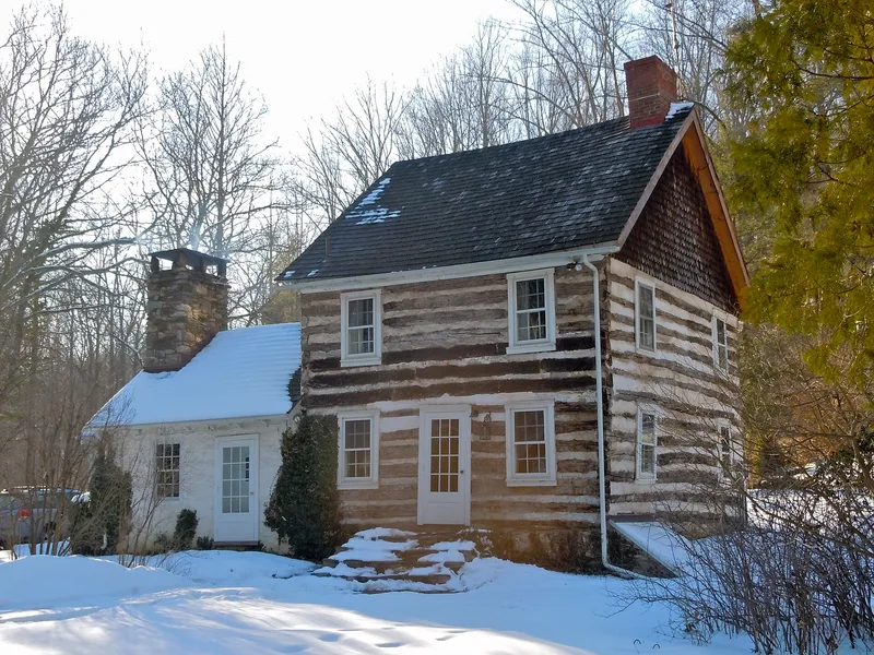
Green Valley is a rural district in Chester County, Pennsylvania, following the drainage basin of Green Valley Creek through East Marlborough and Newlin Townships. Settlement began with a few families in the 18th century, and in the 1860s the valley supported two grist mills, a saw mill, a Baptist church and burial ground, several lime quarries and kilns, and a one-room school built in 1862. Lime was used almost exclusively as a soil sweetener. The Green Valley Farm house, dating from about 1810, is a stone Georgian/Federal transitional building with a handsome all-stone barn. The William Hall house, built about 1795 of log, is a modest 18th-century example that retains its original interior features. Passmore Mill is the only one of the two mills still standing. Much of the valley remains open farmland, and it is valued for its intact landscape and buildings.
Significance in brief: The district is significant for its well-preserved combination of natural landscape and 18th- and 19th-century farms, mills, lime production and a school. The document argues that its land and buildings look much as they did a century earlier, and that its integrity and sense of community are the basis for its significance.
Machine-generated summary. This summary was generated by a language model from the official nomination document and has not been reviewed line by line by an editor. It may contain errors. Check the source document before relying on any detail. Source: nomination document (PDF) · National Archives catalog entry. NRHP reference 85002352, listed September 16, 1985. Summary generated October 2026 (model claude-haiku-5-5, prompt v1.1-2026-10-29, confidence medium).
Key facts
| Address | Green Valley Rd., Newlin & E. Marlborough Twps. |
|---|---|
| County | Chester County |
| Listed | September 16, 1985 |
| Reference number | 85002352 |
| Resource type | District |
| Period of significance | 1700-1899 |
| Architectural style | Georgian/Federal transitional |
| Areas of significance | Industry, Exploration/Settlement |
| Level of significance | Local |
| Status (as stated in the nomination) | Agriculture remains an important activity; several mills, the school, church and lime quarries ceased operation and were converted or demolished. |
| Acreage | 780 |
| Coordinates | 39.92874, -75.75757 (NPS GIS) |
What listing means for this property
This is a historic district. Buildings within its boundary are either contributing (they add to the district's significance) or non-contributing. Owners of contributing income-producing buildings can claim the 20% federal rehabilitation tax credit; homeowners should look at state credits. National Register districts impose no design review by themselves; a local historic district ordinance, if one exists, does (the difference explained).
General information, not legal or tax advice. Rules change; confirm with your State Historic Preservation Office or a qualified adviser.
Sources and further reading
- National Park Service, National Register of Historic Places database (snapshot May 2026), reference 85002352.
- Nomination form (PDF, National Archives) — catalog entry
- Wikipedia article (used for cross-checking only; text not reproduced here)
- Wikidata Q5603376
- This listing as JSON
Last updated October 2026. Found an error? See the editorial policy for how to report it.