Slate Hill Cemetery

Why it's listed
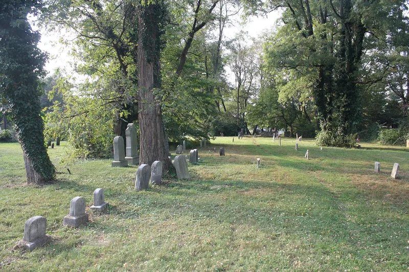
Slate Hill Cemetery in Lower Makefield Township, Bucks County, holds burials dating from 1698 to 1918 across three sections granted in 1690, 1721 and 1788. The oldest section was granted by Thomas Janney to the Falls Meeting of Friends, and the Anderson section was granted to the township as its first public cemetery. Most burials in the Friends section predate 1800, and their markers are plain brownstones with no carving, engraved only with names and dates. The cemetery contains the only seventeenth century gravestone in Bucks County, dated 1698, and an eighteenth century stone dated 1753. Its public section includes six free African Americans who served in Volunteer Colored Regiments during the Civil War. These men came from a free Black community in Yardleyville that had its roots in Quaker manumission. The cemetery is valued for its early gravestones, its Quaker burial traditions and its connection to that community, and it retains very good integrity.
Significance in brief: The cemetery is argued to be one of the two oldest burying places in Bucks County and to contain the only seventeenth century gravestone in the county, dated 1698. It also holds one eighteenth century gravestone dated 1753 and the graves of six free African Americans who served in Volunteer Colored Regiments during the Civil War.
Machine-generated summary. This summary was generated by a language model from the official nomination document and has not been reviewed line by line by an editor. It may contain errors. Check the source document before relying on any detail. Source: nomination document (PDF) · National Archives catalog entry. NRHP reference 92000397, listed April 28, 1992. Summary generated October 2026 (model claude-haiku-5-5, prompt v1.1-2026-10-29, confidence high).
Key facts
| Address | Jct. of Yardley--Morrisville Rd. and Mahlon Dr., Lower Makefield Township, Morrisville |
|---|---|
| County | Bucks County |
| Listed | April 28, 1992 |
| Reference number | 92000397 |
| Resource type | Site |
| Period of significance | 1698-1908 |
| Criteria |
|
| Areas of significance | Black, Exploration/Settlement |
| Level of significance | Local |
| Acreage | 1.3 |
| Coordinates | 40.23246, -74.82711 (NPS GIS) |
What listing means for this property
Sites (archaeological sites, battlefields, landscapes) are often listed with a restricted address to protect them from looting or disturbance. Listing is honorary for private owners; federal undertakings on or near the site go through Section 106 review, and state laws may protect burials and artefacts regardless of listing.
General information, not legal or tax advice. Rules change; confirm with your State Historic Preservation Office or a qualified adviser.
Sources and further reading
- National Park Service, National Register of Historic Places database (snapshot May 2026), reference 92000397.
- Nomination form (PDF, National Archives) — catalog entry
- Wikipedia article (used for cross-checking only; text not reproduced here)
- Wikidata Q7538833
- This listing as JSON
Last updated October 2026. Found an error? See the editorial policy for how to report it.