Langhorne Historic District
Also known as: Attleborough; See Also:Richardson, Joseph, House; Langhorne Li

Why it's listed
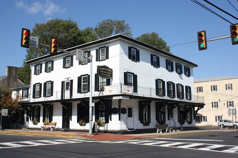
Langhorne began as a crossroads settlement in southern Bucks County where two Lenni-Lenape paths met, later Maple and Bellevue Avenues. Joseph Richardson opened a store in an inn there by 1730 and built a stone house on the southwest corner in 1738, which is the oldest building in the district. Because of its position, Langhorne served as a stage coach transfer point between the Philadelphia to Trenton road and the Bristol to Easton road until railroads replaced stages in the 1870s. Its merchants and craftsmen served farmers between Newtown and Hulmeville. From the 1870s, Philadelphians built large high style houses along South Bellevue and West Maple Avenues. The district contains Federal, Italianate, Second Empire and Queen Anne houses alongside plainer vernacular homes, with buildings dating from 1738 to 1937.
Significance in brief: The district is argued to be important for transportation, commerce and architecture in southern Bucks County. Langhorne was a stage-coach transfer point on the Philadelphia to Trenton and Bristol to Easton routes and a principal eighteenth and nineteenth century service center. Its collection of vernacular and high style architecture is said to be rivaled only by Newtown in the region.
Machine-generated summary. This summary was generated by a language model from the official nomination document and has not been reviewed line by line by an editor. It may contain errors. Check the source document before relying on any detail. Source: nomination document (PDF) · National Archives catalog entry. NRHP reference 87001993, listed November 20, 1987. Summary generated October 2026 (model claude-haiku-5-5, prompt v1.1-2026-10-29, confidence high).
Key facts
| Address | Summit & Marshall Aves., Pine St., Richardson Ave., & Green St., Langhorne |
|---|---|
| County | Bucks County |
| Listed | November 20, 1987 |
| Reference number | 87001993 |
| Resource type | District |
| Period of significance | 1738-1937 |
| Architectural style | Vernacular, with Federal, Italianate, Second Empire, Queen Anne and bungalow examples |
| Areas of significance | Commerce, Transportation, Architecture |
| Level of significance | Local |
| Acreage | 185 |
| Coordinates | 40.17881, -74.91970 (NPS GIS) |
What listing means for this property
This is a historic district. Buildings within its boundary are either contributing (they add to the district's significance) or non-contributing. Owners of contributing income-producing buildings can claim the 20% federal rehabilitation tax credit; homeowners should look at state credits. National Register districts impose no design review by themselves; a local historic district ordinance, if one exists, does (the difference explained).
General information, not legal or tax advice. Rules change; confirm with your State Historic Preservation Office or a qualified adviser.
Sources and further reading
- National Park Service, National Register of Historic Places database (snapshot May 2026), reference 87001993.
- Nomination form (PDF, National Archives) — catalog entry
- Wikipedia article (used for cross-checking only; text not reproduced here)
- Wikidata Q6486105
- This listing as JSON
Last updated October 2026. Found an error? See the editorial policy for how to report it.