Beaver Historic District
Also known as: See Also:Fort McIntosh

Why it's listed
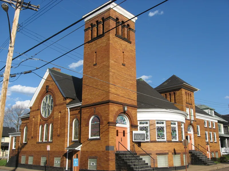
Beaver is a historic district on the Ohio River in Beaver County, Pennsylvania, laid out in 1792 by deputy surveyor Daniel Leet under an 1791 act of the Pennsylvania General Assembly. Its grid of streets surrounds a set of public squares at the core and at each corner of the original plat, a feature the nomination describes as distinctive to the town. The district holds Italianate commercial blocks, Queen Anne and Colonial Revival houses, churches built between 1890 and 1930, two railroad depots, and a 1933 Art Deco courthouse on Agnew Square. Its historic role as a county seat and a residential community, rather than an industrial one, shaped its layout and building stock. The site of the eighteenth-century Fort McIntosh lies within the district and is considered likely to hold significant archaeological remains.
Significance in brief: The nomination argues the district is significant for its 1792 grid plan with public squares, which it describes as an early example of planned urban design in western Pennsylvania. It also cites its role as a residential community and county seat, the Fort McIntosh site, and a collection of architecture spanning the late eighteenth to early twentieth centuries. Its association with Senator Matthew Quay is also noted.
Machine-generated summary. This summary was generated by a language model from the official nomination document and has not been reviewed line by line by an editor. It may contain errors. Check the source document before relying on any detail. Source: nomination document (PDF) · National Archives catalog entry. NRHP reference 96001201, listed October 24, 1996. Summary generated October 2026 (model claude-haiku-5-5, prompt v1.1-2026-10-29, confidence high).
Key facts
| Address | Roughly bounded by the C and P Railroad tracks, Fair Ave., 5th St., 3rd St., and Sassafras Ln., Beaver |
|---|---|
| County | Beaver County |
| Listed | October 24, 1996 |
| Reference number | 96001201 |
| Resource type | District |
| Period of significance | 1778-1946 |
| Architectural style | Late Victorian/Italianate; Late Victorian/Queen Anne; Late 19th & Early 20th Century Revivals/American Foursquare |
| Criteria |
|
| Areas of significance | Architecture, Historic - Non-Aboriginal, Commerce, Politics/Government, Community Planning and Development |
| Level of significance | State |
| Acreage | 317 |
| Coordinates | 40.69596, -80.30567 (NPS GIS) |
What listing means for this property
This is a historic district. Buildings within its boundary are either contributing (they add to the district's significance) or non-contributing. Owners of contributing income-producing buildings can claim the 20% federal rehabilitation tax credit; homeowners should look at state credits. National Register districts impose no design review by themselves; a local historic district ordinance, if one exists, does (the difference explained).
General information, not legal or tax advice. Rules change; confirm with your State Historic Preservation Office or a qualified adviser.
Sources and further reading
- National Park Service, National Register of Historic Places database (snapshot May 2026), reference 96001201.
- Nomination form (PDF, National Archives) — catalog entry
- Wikipedia article (used for cross-checking only; text not reproduced here)
- Wikidata Q110009980
- This listing as JSON
Last updated October 2026. Found an error? See the editorial policy for how to report it.