Maumee Sidecut

Why it's listed
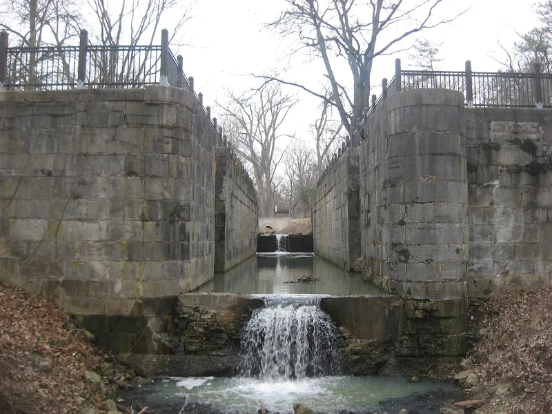
Built in the late 1830s, the Maumee Sidecut was a 1.7-mile canal section that let boats move between the Miami-Erie Canal and the Maumee River. Six locks of cut stone shipped from Marblehead raised or lowered vessels about 50 feet. Surveying began in 1824, but funding disputes, the Ohio-Michigan boundary conflict, rivalry among Toledo, Perrysburg and Maumee over the canal's end, and a financial panic delayed completion until 1842. Traffic began in May 1843. After the full canal opened in 1845, the sidecut was used heavily, and 375 boats passed through in 1848. Extension of the main line into Toledo bypassed it, and the state abandoned it in 1850. It was listed as an outstanding engineering achievement of Ohio's early canal era. Today it forms part of a park. The masonry of locks two, three, four and six remains, lock five carries a bridge, and lock one was removed for a highway.
Significance in brief: The sidecut was part of the Miami-Erie Canal system and sat where traffic bound for the Maumee River left the main line. The nomination calls it one of the outstanding engineering achievements of the early Ohio canal system and stresses its importance to the settlement and growth of northern Ohio. It operated only briefly before the state abandoned it in 1850.
Machine-generated summary. This summary was generated by a language model from the official nomination document and has not been reviewed line by line by an editor. It may contain errors. Check the source document before relying on any detail. Source: nomination document (PDF) · National Archives catalog entry. NRHP reference 73001500, listed April 11, 1973. Summary generated October 2026 (model claude-sonnet-5-5, prompt v1.0-2026-10-29, confidence medium).
Key facts
| Address | N of Maumee River, SW of Ewing Island, Maumee |
|---|---|
| County | Lucas County |
| Listed | April 11, 1973 |
| Reference number | 73001500 |
| Resource type | Structure |
| Period of significance | 1843-1850 |
| Areas of significance | Commerce, Engineering, Transportation |
| Level of significance | State |
| Status (as stated in the nomination) | Now part of a park, owned by the Toledo Metropolitan Park District. Lock one was removed for a highway. Locks two, three, four and six survive as masonry with all hardware missing. Lock five was altered to serve as a bridge base. Condition is marked fair and altered. |
| Acreage | 9 |
| Coordinates | 41.56050, -83.65239 (NPS GIS) |
What listing means for this property
National Register listing is honorary: it recognises significance and does not restrict what a private owner may do without federal money or permits. It unlocks the 20% federal rehabilitation tax credit for income-producing buildings, state credits in many states, and Section 106 review when federal agencies are involved. See what listing means in practice.
General information, not legal or tax advice. Rules change; confirm with your State Historic Preservation Office or a qualified adviser.
Sources and further reading
- National Park Service, National Register of Historic Places database (snapshot May 2026), reference 73001500.
- Nomination form (PDF, National Archives) — catalog entry
- Wikidata Q49262243
- This listing as JSON
Last updated October 2026. Found an error? See the editorial policy for how to report it.