Ida Street Viaduct
Also known as: Ida Street Bridge

Why it's listed
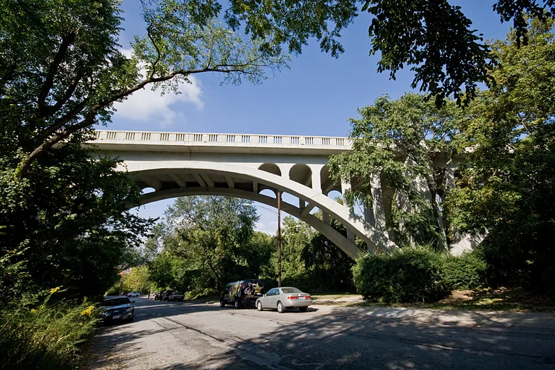
Ida Street Viaduct is a 592-foot reinforced concrete bridge in Cincinnati's Mount Adams neighborhood, carrying Ida Street 44 feet above Wareham Drive. Completed in 1931 at a cost of about $90,000, it has two ribbed arch spans of roughly 138 feet each, with three small spans at either end, pylons atop the piers and a fluted railing. It replaced a wooden trestle built in 1882 for the incline railway company. Its main claim to attention is the lighting: 33 two-hundred-watt lamps recessed into the railings, fitted with lenses that spread light across the roadway and direct it upward. This was reportedly the first such installation, and the idea was later used on the Western Hills Viaduct. Structural engineer J.R. Biedinger is credited with the work, though credit for the artistic concept has been disputed. Streetcar tracks were removed in 1949, the only alteration, so the original design and lighting survive. It is one of eight major concrete viaducts in the city.
Significance in brief: The nomination argues the bridge embodies an innovative 20th century engineering and design scheme, with indirect lighting recessed into the hand railings. It was the first use of this type of lighting, and the system was later adapted for the Western Hills Viaduct. It is also described as the only one of Cincinnati's major concrete viaducts left unaltered, and as a prominent hillside landmark.
Machine-generated summary. This summary was generated by a language model from the official nomination document and has not been reviewed line by line by an editor. It may contain errors. Check the source document before relying on any detail. Source: nomination document (PDF) · National Archives catalog entry. NRHP reference 80003060, listed November 28, 1980. Summary generated October 2026 (model claude-sonnet-5-5, prompt v1.0-2026-10-29, confidence high).
Key facts
| Address | Ida St. between Monastery and Paradrome Sts., Cincinnati |
|---|---|
| County | Hamilton County |
| Listed | November 28, 1980 |
| Reference number | 80003060 |
| Resource type | Structure |
| Period of significance | 1900- (specific date 1931) |
| Architect / builder | Engineer, J.R. Biedinger |
| Areas of significance | Engineering, Transportation |
| Level of significance | Local |
| Status (as stated in the nomination) | Publicly owned and in use for transportation. The upper deck is described as greatly in need of repair because of heavy traffic. |
| Acreage | 0.9 |
| Coordinates | 39.10543, -84.49448 (NPS GIS) |
What listing means for this property
National Register listing is honorary: it recognises significance and does not restrict what a private owner may do without federal money or permits. It unlocks the 20% federal rehabilitation tax credit for income-producing buildings, state credits in many states, and Section 106 review when federal agencies are involved. See what listing means in practice.
General information, not legal or tax advice. Rules change; confirm with your State Historic Preservation Office or a qualified adviser.
Sources and further reading
- National Park Service, National Register of Historic Places database (snapshot May 2026), reference 80003060.
- Nomination form (PDF, National Archives) — catalog entry
- Wikipedia article (used for cross-checking only; text not reproduced here)
- Wikidata Q5987204
- This listing as JSON
Last updated October 2026. Found an error? See the editorial policy for how to report it.