Campbell Mound
Also known as: James E. Campbell Mound State Memorial; Shrum Mound

Why it's listed
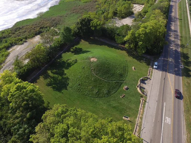
Campbell Mound is a conical earthen burial mound in a small roadside park on McKinley Avenue in Columbus, beside a limestone quarry. It stands about 20 feet high and 100 feet across, with a large tree on top, grass-covered slopes and steps leading to the summit for a view of the area. The mound was probably built in Late Adena times, toward the end of the period from about 500 B.C. to 400 A.D. It may have been raised quickly, or it may have begun small and grown over hundreds of years, in which case excavation could reveal changes in burial styles and artifacts. It is named for James E. Campbell, governor of Ohio from 1890 to 1892, whose daughter gave it to the Ohio Historical Society in 1928. Its older name, Shrum, comes from the family that owned the site for many years. It is the only prehistoric Indian burial mound preserved for public appreciation within Columbus. Some restoration followed damage by relic hunters.
Significance in brief: The nomination calls it a fine example of a relatively large conical Adena mound, probably built in Late Adena times. It is the only prehistoric Indian burial mound preserved for public appreciation within Columbus. Excavation could show changes in burial styles and artifacts if the mound grew over hundreds of years.
Machine-generated summary. This summary was generated by a language model from the official nomination document and has not been reviewed line by line by an editor. It may contain errors. Check the source document before relying on any detail. Source: nomination document (PDF) · National Archives catalog entry. NRHP reference 70000490, listed November 10, 1970. Summary generated October 2026 (model claude-sonnet-5-5, prompt v1.0-2026-10-29, confidence medium).
Key facts
| Address | McKinley Ave., Columbus |
|---|---|
| County | Franklin County |
| Listed | November 10, 1970 |
| Reference number | 70000490 |
| Resource type | Structure |
| Period of significance | ca. 500 B.C.-400 A.D. |
| Areas of significance | Prehistoric |
| Level of significance | State |
| Status (as stated in the nomination) | Condition listed as excellent; some restoration after relic hunters dug into the side. Owned by the Ohio Historical Society and open to the public as a state memorial park. |
| Acreage | 1 |
| Coordinates | 39.99006, -83.08074 (NPS GIS) |
What listing means for this property
National Register listing is honorary: it recognises significance and does not restrict what a private owner may do without federal money or permits. It unlocks the 20% federal rehabilitation tax credit for income-producing buildings, state credits in many states, and Section 106 review when federal agencies are involved. See what listing means in practice.
General information, not legal or tax advice. Rules change; confirm with your State Historic Preservation Office or a qualified adviser.
Sources and further reading
- National Park Service, National Register of Historic Places database (snapshot May 2026), reference 70000490.
- Nomination form (PDF, National Archives) — catalog entry
- Wikipedia article (used for cross-checking only; text not reproduced here)
- Wikidata Q28403189
- This listing as JSON
Last updated October 2026. Found an error? See the editorial policy for how to report it.