Cedar Point Light

Why it's listed
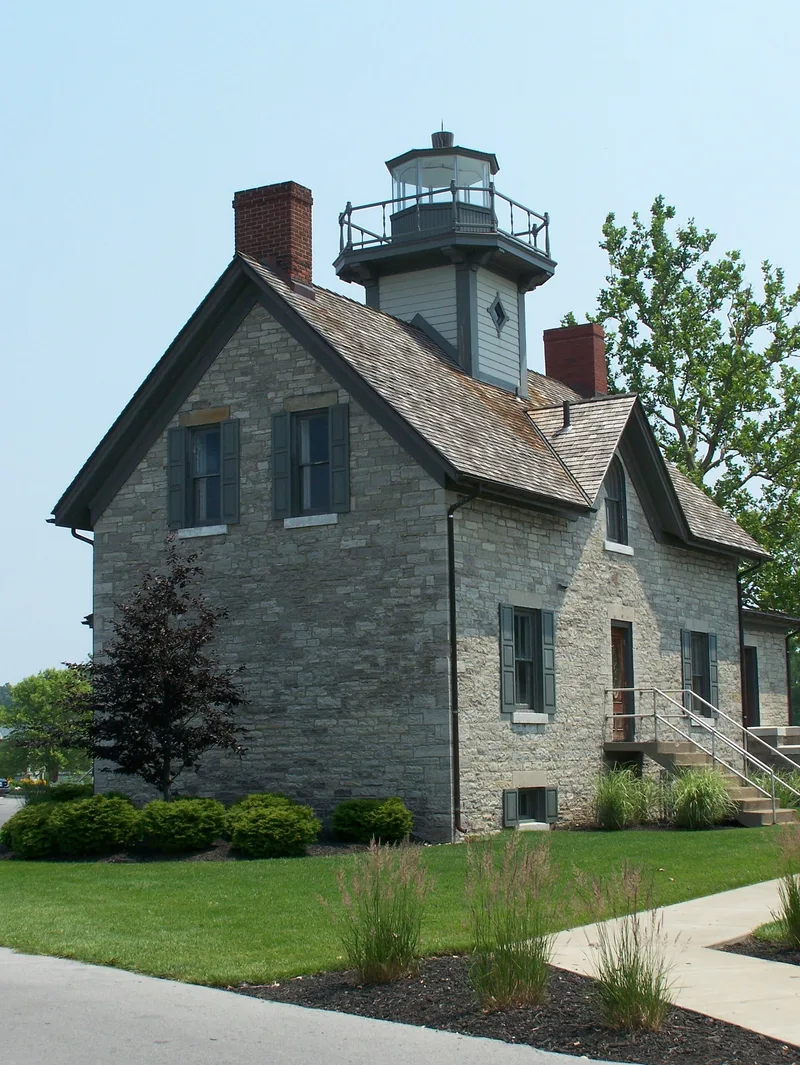
Cedar Point Light is a one-story limestone building at the northwest tip of Cedar Point, at the entrance to Sandusky Bay on Lake Erie. A light was first established here in 1838, and the station was rebuilt in 1862 using the same arrangement as before, with the light tower rising from the roof of a six-room keeper's dwelling. The rectangular building is laid in random ashlar, with double-hung windows under dressed stone sills and lintels, a gable roof, two brick end chimneys and a gabled wall dormer with a round-arch window above the central entrance. The light was abandoned by 1909, but the house continued as a residence for the keeper of the Sandusky Bay Range Lights and later served as a Coast Guard station. The tower has been removed, a porch was enclosed at the rear and the interior has been heavily altered. A square iron oil house remains nearby. It is regarded as one of the oldest surviving lighthouses on Lake Erie.
Significance in brief: The inventory describes it as one of the oldest surviving lighthouses on Lake Erie. It reflects the practice of placing the light tower on the roof of the keeper's dwelling, a plan adopted at Cedar Point in 1838 and again in 1862. It was later used as a Coast Guard station and houses an Aids to Navigation Team.
Machine-generated summary. This summary was generated by a language model from the official nomination document and has not been reviewed line by line by an editor. It may contain errors. Check the source document before relying on any detail. Source: nomination document (PDF) · National Archives catalog entry. NRHP reference 84003667, listed July 19, 1984. Summary generated October 2026 (model claude-sonnet-5-5, prompt v1.0-2026-10-29, confidence medium).
Key facts
| Address | Cedar Point, Sandusky |
|---|---|
| County | Erie County |
| Listed | July 19, 1984 |
| Reference number | 84003667 |
| Resource type | Building |
| Areas of significance | Engineering, Transportation |
| Level of significance | State |
| Status (as stated in the nomination) | Condition rated good but altered; the light tower has been removed and the interior extensively altered. Presently used as a U.S. Coast Guard Aids to Navigation Team office. |
| Acreage | 1 |
| Coordinates | 41.48802, -82.69344 (NPS GIS) |
What listing means for this property
National Register listing is honorary: it recognises significance and does not restrict what a private owner may do without federal money or permits. It unlocks the 20% federal rehabilitation tax credit for income-producing buildings, state credits in many states, and Section 106 review when federal agencies are involved. See what listing means in practice.
General information, not legal or tax advice. Rules change; confirm with your State Historic Preservation Office or a qualified adviser.
Sources and further reading
- National Park Service, National Register of Historic Places database (snapshot May 2026), reference 84003667.
- Nomination form (PDF, National Archives) — catalog entry
- Wikipedia article (used for cross-checking only; text not reproduced here)
- Wikidata Q5056836
- This listing as JSON
Last updated October 2026. Found an error? See the editorial policy for how to report it.