Lane's Mill Historic Buildings

Why it's listed
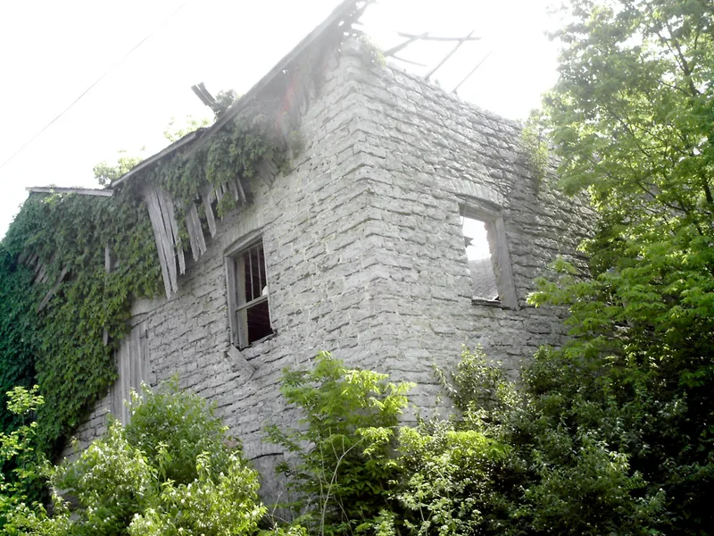
Lane's Mill is a rural grist mill complex beside Four Mile Creek, south of Oxford in Butler County, Ohio. The centerpiece is a three-story rectangular mill of rock-faced limestone quarried from the creek, built between 1848 and 1850 by William Elliot. Milling had taken place on the site since 1816, and the mill was powered by an undershot wheel fed by a race built for earlier mills. Inside are original French buhrstone millstones and stencils for Lane Family Flour. Elliot also built the L-shaped frame farmhouse in 1853, shortly before he was killed in an accident at the mill. The mill took its name from William Lane, who owned it until 1898. The nominated area of roughly 27 acres also takes in farm outbuildings and the head and tail races, which run about 3,000 feet beside the creek. The group was recognized as a significant example of nineteenth-century milling in Butler County, a leading corn-producing area, and as one of the finest stone mills in southwestern Ohio.
Significance in brief: The nomination presents the group as a significant embodiment of nineteenth-century mill activity in rural Butler County. The stone mill is described as one of the few, and probably the finest, examples of stone mill architecture in southwestern Ohio. The site has been used for milling since 1816, and Butler County was the state's largest producer of Indian corn in 1850.
Machine-generated summary. This summary was generated by a language model from the official nomination document and has not been reviewed line by line by an editor. It may contain errors. Check the source document before relying on any detail. Source: nomination document (PDF) · National Archives catalog entry. NRHP reference 80002950, listed October 3, 1980. Summary generated October 2026 (model claude-sonnet-5-5, prompt v1.0-2026-10-29, confidence high).
Key facts
| Address | S of Oxford at 3884 Wallace Rd., Oxford |
|---|---|
| County | Butler County |
| Listed | October 3, 1980 |
| Reference number | 80002950 |
| Resource type | District |
| Period of significance | 1800-1899 |
| Architect / builder | William Elliot |
| Areas of significance | Industry, Agriculture |
| Level of significance | Local |
| Status (as stated in the nomination) | Condition is listed as good and altered, on its original site. The mill race is largely overgrown but still discernible. The property is occupied, with some parts unoccupied, and is used for agriculture, as a private residence and for storage. |
| Acreage | 27 |
| Coordinates | 39.48255, -84.69218 (NPS GIS) |
What listing means for this property
This is a historic district. Buildings within its boundary are either contributing (they add to the district's significance) or non-contributing. Owners of contributing income-producing buildings can claim the 20% federal rehabilitation tax credit; homeowners should look at state credits. National Register districts impose no design review by themselves; a local historic district ordinance, if one exists, does (the difference explained).
General information, not legal or tax advice. Rules change; confirm with your State Historic Preservation Office or a qualified adviser.
Sources and further reading
- National Park Service, National Register of Historic Places database (snapshot May 2026), reference 80002950.
- Nomination form (PDF, National Archives) — catalog entry
- Wikipedia article (used for cross-checking only; text not reproduced here)
- Wikidata Q6485322
- This listing as JSON
Last updated October 2026. Found an error? See the editorial policy for how to report it.