Dilworth Historic District

Why it's listed
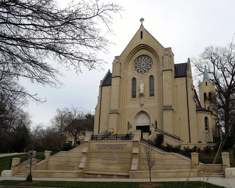
Dilworth is a streetcar suburb in Charlotte, North Carolina, spread over roughly 63 blocks and 395 acres. Developer Edward Latta began it in 1891 with a grid of streets ringed by a boulevard and park, through which the city's first streetcar line ran. In 1912 a southern section followed a plan by the Olmsted Brothers, and a northern curvilinear section was platted in 1920. The district holds more than a thousand inventoried buildings, mostly single and multi-family houses, along with churches, a school and commercial structures. About 82 percent of the principal buildings contribute to its character. Late Victorian and Queen Anne houses mark the earliest years, followed by Colonial Revival mansions and cottages, Four Square houses, and many Bungalows, some designed by Fred L. Bonfoey. Architect Charles C. Hook supplied plans for Colonial Revival homes. Latta Park, once a ninety-acre amusement park, lies within the district. Together the buildings and street plans show how a planned suburb grew between 1891 and 1941.
Significance in brief: The nomination presents Dilworth as Charlotte's first streetcar suburb, with a large collection of late nineteenth and early twentieth century architecture. It was laid out in three phases, including a 1912 curvilinear plan by the Olmsted Brothers. Its Colonial Revival, Period Revival and Bungalow buildings remain consistent in character across all phases.
Machine-generated summary. This summary was generated by a language model from the official nomination document and has not been reviewed line by line by an editor. It may contain errors. Check the source document before relying on any detail. Source: nomination document (PDF) · National Archives catalog entry. NRHP reference 87000610, listed April 9, 1987. Summary generated October 2026 (model claude-sonnet-5-5, prompt v1.0-2026-10-29, confidence medium).
Key facts
| Address | Roughly bounded by Myrtle, Morehead, Berkeley, Dilworth Rd. W, Charlotte, Park, Tremont, Cleveland and Renssalaer, Charlotte |
|---|---|
| County | Mecklenburg County |
| Listed | April 9, 1987 |
| Reference number | 87000610 |
| Resource type | District |
| Period of significance | 1891-1941 |
| Architect / builder | Olmsted Brothers (landscape plan); Charles C. Hook; Fred L. Bonfoey; W. H. Peeps |
| Architectural style | Colonial Revival, Picturesque or Period Revival, Bungalow, with Victorian, Queen Anne and Four Square examples |
| Areas of significance | Community Planning and Development, Landscape Architecture, Architecture |
| Level of significance | Local |
| Status (as stated in the nomination) | Occupied; mostly private residences with some commercial and religious use. Condition is marked excellent, good and fair. About 82 percent of principal buildings contribute to the district. |
| Acreage | 395 |
| Coordinates | 35.20266, -80.85000 (NPS GIS) |
What listing means for this property
This is a historic district. Buildings within its boundary are either contributing (they add to the district's significance) or non-contributing. Owners of contributing income-producing buildings can claim the 20% federal rehabilitation tax credit; homeowners should look at state credits. National Register districts impose no design review by themselves; a local historic district ordinance, if one exists, does (the difference explained).
General information, not legal or tax advice. Rules change; confirm with your State Historic Preservation Office or a qualified adviser.
Sources and further reading
- National Park Service, National Register of Historic Places database (snapshot May 2026), reference 87000610.
- Nomination form (PDF, National Archives) — catalog entry
- Wikipedia article (used for cross-checking only; text not reproduced here)
- Wikidata Q5277098
- This listing as JSON
Last updated October 2026. Found an error? See the editorial policy for how to report it.