Old Cochecton Cemetery

Why it's listed
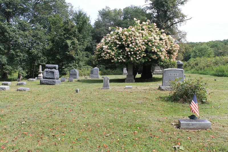
Old Cochecton Cemetery, also called Taylor's Eddy Cemetery, sits on the bank of the Delaware River in Sullivan County, New York, with the railroad tracks between it and the nearby community. Used from about 1774, it is believed to be the oldest surviving burying ground in the Upper Delaware valley. Early settlers, including members of the Tyler and Calkins families, were buried near the river, and some were brought by canoe. The oldest graves have fieldstone markers, many damaged by an 1857 ice jam and flood. Marble headstones began appearing in 1829, and the upper terrace holds Victorian-era tablets and obelisks. About 150 burials are believed to be present. Ebenezer Taylor, who built a nearby inn and store in the 1790s, maintained the site, and the Presbyterian Church took over its care in 1872. It was listed for its age and its link to early settlement, and for having very few post-1942 memorials.
Significance in brief: The nomination argues the cemetery is believed to be the oldest surviving burying ground in the Upper Delaware valley and ties directly to its first white settlers, including the Tyler and Calkins families. It is one of the few intact reminders of pre-19th-century community life. It also keeps a high level of integrity, with very few markers dated after 1942.
Machine-generated summary. This summary was generated by a language model from the official nomination document and has not been reviewed line by line by an editor. It may contain errors. Check the source document before relying on any detail. Source: nomination document (PDF) · National Archives catalog entry. NRHP reference 92001593, listed November 27, 1992. Summary generated October 2026 (model claude-sonnet-5-5, prompt v1.0-2026-10-29, confidence high).
Key facts
| Address | W of NY 97, N of jct. with Co. Rd. 114, Cochecton |
|---|---|
| County | Sullivan County |
| Listed | November 27, 1992 |
| Reference number | 92001593 |
| Resource type | Site |
| Period of significance | 1774-1942 |
| Criteria |
|
| Areas of significance | Exploration/Settlement |
| Level of significance | Local |
| Status (as stated in the nomination) | Still in use as a cemetery; the latest recorded burial is from 1978 and all available plot space appears to be used. The grounds are mowed by caretakers. |
| Acreage | 1 |
| Coordinates | 41.71129, -75.04914 (NPS GIS) |
What listing means for this property
Sites (archaeological sites, battlefields, landscapes) are often listed with a restricted address to protect them from looting or disturbance. Listing is honorary for private owners; federal undertakings on or near the site go through Section 106 review, and state laws may protect burials and artefacts regardless of listing.
General information, not legal or tax advice. Rules change; confirm with your State Historic Preservation Office or a qualified adviser.
Sources and further reading
- National Park Service, National Register of Historic Places database (snapshot May 2026), reference 92001593.
- Nomination form (PDF, National Archives) — catalog entry
- Wikipedia article (used for cross-checking only; text not reproduced here)
- Wikidata Q14707135
- This listing as JSON
Last updated October 2026. Found an error? See the editorial policy for how to report it.