Sagaponack Historic District

Why it's listed
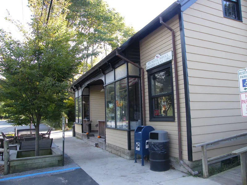
Sagaponack Historic District covers roughly 307 acres in the center of a hamlet on the South Fork of Long Island. Its backbone is Sagaponack Main Street, with parts of six side streets. The area began as the first lots of the Sagaponack Division of Southampton in 1653, and the street plan, burying ground and common from the late seventeenth century remain. The earliest surviving house is thought to date to 1692. Later houses reflect Federal, Greek Revival, Gothic Revival, Italianate, Queen Anne, Shingle and Colonial Revival styles. After the Long Island Rail Road arrived in 1870, summer visitors came, and boarding houses and second homes were added. Barns, potato storage buildings, worker housing and open fields record the farming economy. The district includes 131 contributing buildings, a school built in 1885, a general store and post office, and a burying ground. Unsubdivided farmland is included to show the historic rural setting, which faces development pressure.
Significance in brief: The district preserves the settlement pattern of a hamlet first divided in 1653 and 1677, with a 17th-century burying ground, common and street plan. Its houses, barns, boarding houses and worker housing show the agricultural economy and the later summer-resort trade after the Long Island Rail Road arrived in 1870. Surviving farmland is included to convey the historic rural setting.
Machine-generated summary. This summary was generated by a language model from the official nomination document and has not been reviewed line by line by an editor. It may contain errors. Check the source document before relying on any detail. Source: nomination document (PDF) · National Archives catalog entry. NRHP reference 00000582, listed June 2, 2000. Summary generated October 2026 (model claude-sonnet-5-5, prompt v1.0-2026-10-29, confidence medium).
Key facts
| Address | Roughly along Main St., Southampton |
|---|---|
| County | Suffolk County |
| Listed | June 2, 2000 |
| Reference number | 00000582 |
| Resource type | District |
| Architect / builder | James Ware and Sons of New York City ("Winnecoma," 1899); most other buildings by local builders or unknown |
| Architectural style | Colonial/Postmedieval English, Federal, Greek and Gothic Revival, Italianate, Queen Anne, Colonial Revival, Bungalow/Shingle Style |
| Areas of significance | Exploration/Settlement, Architecture |
| Level of significance | Local |
| Status (as stated in the nomination) | Still largely residential and agricultural; the school and general store/post office remain in use. The document describes the rural character as threatened by development pressure. |
| Acreage | 307 |
| Coordinates | 40.92524, -72.27861 (NPS GIS) |
What listing means for this property
This is a historic district. Buildings within its boundary are either contributing (they add to the district's significance) or non-contributing. Owners of contributing income-producing buildings can claim the 20% federal rehabilitation tax credit; homeowners should look at state credits. National Register districts impose no design review by themselves; a local historic district ordinance, if one exists, does (the difference explained).
General information, not legal or tax advice. Rules change; confirm with your State Historic Preservation Office or a qualified adviser.
Sources and further reading
- National Park Service, National Register of Historic Places database (snapshot May 2026), reference 00000582.
- Nomination form (PDF, National Archives) — catalog entry
- Wikipedia article (used for cross-checking only; text not reproduced here)
- Wikidata Q7398998
- This listing as JSON
Last updated October 2026. Found an error? See the editorial policy for how to report it.