East Hampton Village Historic District (Boundary Increase)
Also known as: See Also:East Hampton Village Historic District

Why it's listed
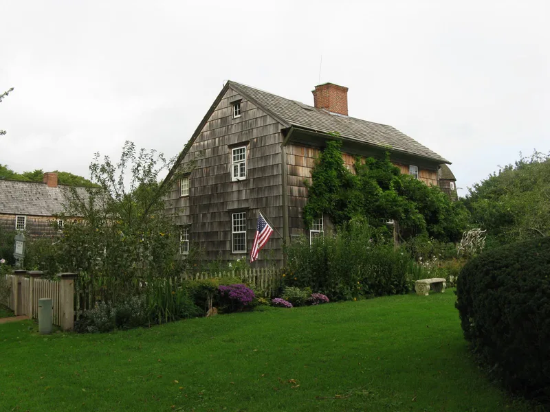
This boundary expansion enlarges the East Hampton Village Historic District, first listed in 1974, to about 485 acres. The enlarged district holds 270 contributing buildings, 11 contributing structures and the Village Green, laid out in 1648. Around the green stand some of the village's earliest houses, including the c. 1680 Mulford House and the c. 1710 Home Sweet Home Museum, along with the Thomas Moran house and studio and early twentieth century buildings such as St. Luke's Church, the East Hampton Free Library and Guild Hall. North of the green, Main Street is a broad, elm-lined avenue of eighteenth- and nineteenth-century houses, ending in a row of small commercial buildings. Side streets such as Jeffreys Lane, Dunemere Lane and Huntting Lane add Victorian and resort-era residences. The largest area, the Summer Colony, has nearly 100 large houses, mostly Shingle style, on landscaped lots near the ocean. The boundary follows lines of intact historic streetscapes and excludes non-historic development.
Significance in brief: The expansion adds contiguous areas with strong concentrations of historic buildings and intact streetscapes, from the village's seventeenth-century settlement core to late nineteenth and early twentieth century resort estates. It includes early vernacular houses, works by prominent architects such as Aymar Embury II and Thomas Nash, and a large group of Shingle style summer houses. The enlarged district counts 282 contributing features.
Machine-generated summary. This summary was generated by a language model from the official nomination document and has not been reviewed line by line by an editor. It may contain errors. Check the source document before relying on any detail. Source: nomination document (PDF) · National Archives catalog entry. NRHP reference 88001032, listed July 21, 1988. Summary generated October 2026 (model claude-sonnet-5-5, prompt v1.0-2026-10-29, confidence medium).
Key facts
| Address | Northeastward along Main St. to Newton La. and Southwestward along Ocean and Lee Aves. and Pond La. to Hedges La., East Hampton |
|---|---|
| County | Suffolk County |
| Listed | July 21, 1988 |
| Reference number | 88001032 |
| Resource type | District |
| Architect / builder | Aymar Embury II; Thomas Nash; J.G. Thorp; Albro and Lindeberg; Grosvenor Atterbury; Roger Bullard; J.C. Lawrence |
| Architectural style | Vernacular settlement-period, Georgian, Federal, Greek Revival, Queen Anne, Shingle style, Colonial Revival, Tudor and Elizabethan revival |
| Areas of significance | Exploration/Settlement, Architecture |
| Level of significance | Local |
| Acreage | 485 |
| Coordinates | 40.95154, -72.19535 (NPS GIS) |
What listing means for this property
This is a historic district. Buildings within its boundary are either contributing (they add to the district's significance) or non-contributing. Owners of contributing income-producing buildings can claim the 20% federal rehabilitation tax credit; homeowners should look at state credits. National Register districts impose no design review by themselves; a local historic district ordinance, if one exists, does (the difference explained).
General information, not legal or tax advice. Rules change; confirm with your State Historic Preservation Office or a qualified adviser.
Sources and further reading
- National Park Service, National Register of Historic Places database (snapshot May 2026), reference 88001032.
- Nomination form (PDF, National Archives) — catalog entry
- Wikipedia article (used for cross-checking only; text not reproduced here)
- Wikidata Q5328543
- This listing as JSON
Last updated October 2026. Found an error? See the editorial policy for how to report it.