Long Island Motor Parkway

Why it's listed
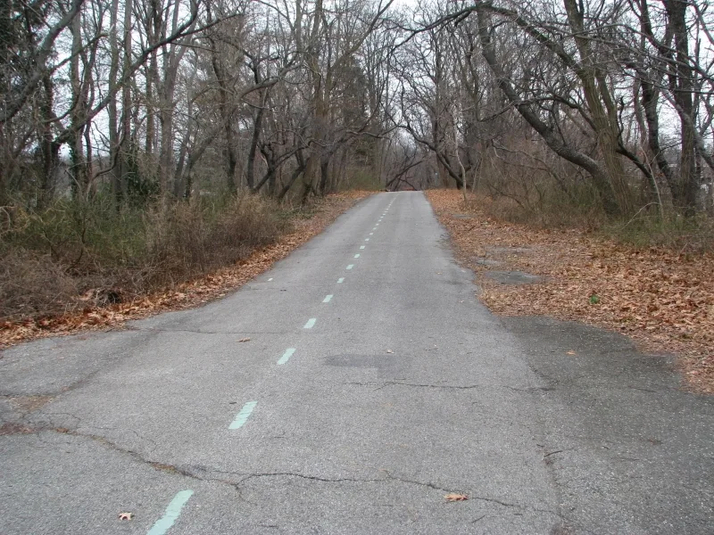
Two surviving stretches of the Long Island Motor Parkway cross parts of Queens, running through Alley Pond Park and Cunningham Park. The parkway was conceived by William K. Vanderbilt, Jr. as a private toll road for automobiles after a deadly 1906 Vanderbilt Cup race. Construction began in 1908, and the road stayed in use until 1938, when newer parkways planned by Robert Moses had superseded it. The district contains seven contributing structures, two roadway sections and five reinforced concrete bridges, along with entrance and exit ramps, concrete bollards and right-of-way markers. One later bridge does not contribute. The Queens portion was built in stages: the eastern part by 1911, and the western extension in 1924-26. Later asphalt covers the original surface in many places, and the road became a bicycle path in 1938. It is considered the earliest paved, limited-access automobile parkway in America, with no grade crossings and a design aimed at pleasure driving.
Significance in brief: The nomination argues it is the earliest limited-access, paved automobile parkway in America and probably the world, significant for transportation and recreation history (Criterion A). It also embodies the design characteristics of an automobile parkway, such as no grade crossings and a road built for pleasure driving (Criterion C).
Machine-generated summary. This summary was generated by a language model from the official nomination document and has not been reviewed line by line by an editor. It may contain errors. Check the source document before relying on any detail. Source: nomination document (PDF) · National Archives catalog entry. NRHP reference 02000301, listed April 1, 2002. Summary generated October 2026 (model claude-sonnet-5-5, prompt v1.0-2026-10-29, confidence high).
Key facts
| Address | Roughly Alley Pond and Cunningham Parks, bet. Winchester Blvd. and Clearview Expressway, bet. 73rd Ave. and Peck Ave., Queens |
|---|---|
| County | Queens |
| Listed | April 1, 2002 |
| Reference number | 02000301 |
| Resource type | District |
| Period of significance | 1906-1938 |
| Architect / builder | Williams, E.G., chief engineer; Brown, E. H., assistant |
| Architectural style | Other: Parkway |
| Criteria |
|
| Areas of significance | Transportation, Entertainment/Recreation |
| Level of significance | Local |
| Status (as stated in the nomination) | No longer used for automobile traffic; the roadway was converted to a bicycle path in 1938 and is now used as a bicycle path and park pathway. |
| Acreage | 10 |
| Coordinates | 40.73644, -73.76220 (NPS GIS) |
What listing means for this property
This is a historic district. Buildings within its boundary are either contributing (they add to the district's significance) or non-contributing. Owners of contributing income-producing buildings can claim the 20% federal rehabilitation tax credit; homeowners should look at state credits. National Register districts impose no design review by themselves; a local historic district ordinance, if one exists, does (the difference explained).
General information, not legal or tax advice. Rules change; confirm with your State Historic Preservation Office or a qualified adviser.
Sources and further reading
- National Park Service, National Register of Historic Places database (snapshot May 2026), reference 02000301.
- Nomination form (PDF, National Archives) — catalog entry
- Wikipedia article (used for cross-checking only; text not reproduced here)
- Wikidata Q1869352
- This listing as JSON
Last updated October 2026. Found an error? See the editorial policy for how to report it.