Gilead Cemetery

Why it's listed
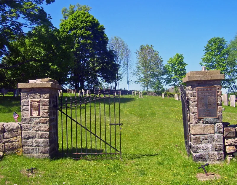
Gilead Cemetery is a small burying ground on Mechanic Street south of the hamlet of Carmel, in Putnam County. It covers 1.24 acres and is enclosed by a cut fieldstone wall, with wrought-iron gates added in 1914. A fifty-foot-square meetinghouse used by Gilead Church stood on the site from 1756 until 1839, and the first burial took place in 1766. The cemetery holds 310 headstones and 199 footstones in fieldstone, slate, red sandstone, marble and granite. Carvings include death heads, cherub heads, starbursts, and the urn and willow designs common in the nineteenth century. A large monument to Enoch Crosby, a Revolutionary War figure, replaced a vandalized original marker. The cemetery was listed for its connection to Carmel's settlement history, for the genealogical and population information on its markers, and for the quality and quantity of its funerary art. Use declined after Raymond Hill Cemetery opened, and the last burial was in 1959.
Significance in brief: The cemetery is tied to the settlement-era history of the hamlet of Carmel, and its markers hold genealogical and demographic information about local families. It also holds an unusually large collection of carved grave markers in fieldstone, slate, red sandstone, marble and granite, showing the range of late eighteenth- and nineteenth-century funerary art.
Machine-generated summary. This summary was generated by a language model from the official nomination document and has not been reviewed line by line by an editor. It may contain errors. Check the source document before relying on any detail. Source: nomination document (PDF) · National Archives catalog entry. NRHP reference 88002684, listed December 1, 1988. Summary generated October 2026 (model claude-sonnet-5-5, prompt v1.0-2026-10-29, confidence medium).
Key facts
| Address | Mechanic St., Carmel |
|---|---|
| County | Putnam County |
| Listed | December 1, 1988 |
| Reference number | 88002684 |
| Resource type | Site |
| Period of significance | 1766-1929 |
| Areas of significance | Art, Exploration/Settlement |
| Level of significance | Local |
| Status (as stated in the nomination) | Under the custody of the Town of Carmel, with help from Town of Carmel Historical Society volunteers. Some markers are broken and the grounds have suffered periodic neglect since 1971, though integrity is described as high. |
| Acreage | 1.2 |
| Coordinates | 41.40830, -73.67312 (NPS GIS) |
What listing means for this property
Sites (archaeological sites, battlefields, landscapes) are often listed with a restricted address to protect them from looting or disturbance. Listing is honorary for private owners; federal undertakings on or near the site go through Section 106 review, and state laws may protect burials and artefacts regardless of listing.
General information, not legal or tax advice. Rules change; confirm with your State Historic Preservation Office or a qualified adviser.
Sources and further reading
- National Park Service, National Register of Historic Places database (snapshot May 2026), reference 88002684.
- Nomination form (PDF, National Archives) — catalog entry
- Wikipedia article (used for cross-checking only; text not reproduced here)
- Wikidata Q8509725
- This listing as JSON
Last updated October 2026. Found an error? See the editorial policy for how to report it.