African-American Cemetery, The
Also known as: "Colored Cemetery"

Why it's listed
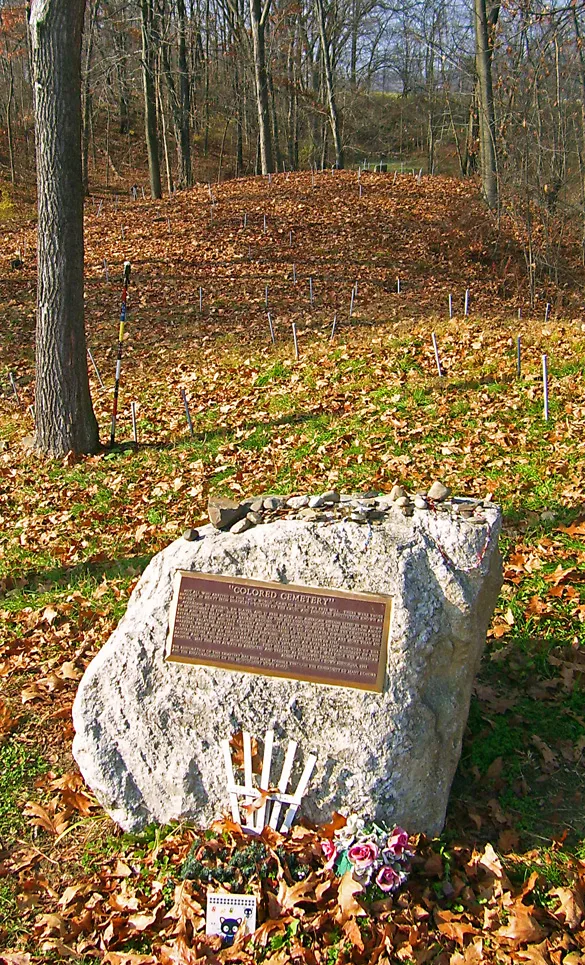
Set beside County Route 416 in Montgomery, New York, this small half-acre burial ground, also known as the "Colored Cemetery," holds 171 known grave markers, nearly all of them upright, unfinished fieldstones. Two carry inscriptions, one dated 1756. Researchers estimate at least 86 burials. The graves lie on a low knoll and along the old roadbed, next to a swamp. The land was part of the early German settlement begun by Johannes Miller in 1727, and the cemetery may have begun as a burying place for enslaved people held by settlers, later serving free Black residents. Burials are thought to have continued until about 1900. An 1867 deed set aside the plot as one used by the Colored people as a cemetery, though later land transfers overlooked it. The site fell into neglect before the town acquired it in 1996. It is valued as the largest known African-American burial ground in the town and as a source of information on burial customs.
Significance in brief: The nomination argues it is the largest known African-American burial ground in the town of Montgomery and among the earliest and largest identified in Orange County. It is a rare surviving burying ground for the area's Black population, including enslaved and free people. It is likely to yield information about African-American life ways and funerary customs in the eighteenth and nineteenth centuries.
Machine-generated summary. This summary was generated by a language model from the official nomination document and has not been reviewed line by line by an editor. It may contain errors. Check the source document before relying on any detail. Source: nomination document (PDF) · National Archives catalog entry. NRHP reference 96000862, listed August 16, 1996. Summary generated October 2026 (model claude-sonnet-5-5, prompt v1.0-2026-10-29, confidence high).
Key facts
| Address | Co. Rt. 416, approximately .5 mi. S of jct. with NY 84, Montgomery |
|---|---|
| County | Orange County |
| Listed | August 16, 1996 |
| Reference number | 96000862 |
| Resource type | Site |
| Period of significance | ca.1750 - ca. 1900 |
| Criteria |
|
| Areas of significance | Historic - Non-Aboriginal, Social History, Exploration/Settlement, Black |
| Level of significance | State |
| Status (as stated in the nomination) | Inactive cemetery, undisturbed and intact. The town of Montgomery acquired it in 1996, cleared undergrowth, and added a rail fence, memorial tablet and historic marker. |
| Acreage | 0.9 |
| Coordinates | 41.50459, -74.25430 (NPS GIS) |
What listing means for this property
Sites (archaeological sites, battlefields, landscapes) are often listed with a restricted address to protect them from looting or disturbance. Listing is honorary for private owners; federal undertakings on or near the site go through Section 106 review, and state laws may protect burials and artefacts regardless of listing.
General information, not legal or tax advice. Rules change; confirm with your State Historic Preservation Office or a qualified adviser.
Sources and further reading
- National Park Service, National Register of Historic Places database (snapshot May 2026), reference 96000862.
- Nomination form (PDF, National Archives) — catalog entry
- Wikipedia article (used for cross-checking only; text not reproduced here)
- Wikidata Q4689616
- This listing as JSON
Last updated October 2026. Found an error? See the editorial policy for how to report it.